The past few months have been difficult. We’ve lost close friends, all of them much too soon. And during those months, we were also slowly losing my mother. At 99, it wasn’t unexpected. She didn’t have dementia exactly, but she was getting confused and seemed to be spending more and more time deep inside herself. It is, I’ve been told, a characteristic of people who will soon leave.
And leave us she did. One Monday morning in September, she woke up as usual, ate breakfast, walked to the park just down the road, and continued her typical day. When she woke up the next morning, she didn’t want breakfast. Then she didn’t want lunch or her usual rye and water. Or dinner. And that was that. Ten days later, September 23, resting in her bedroom of over 50 years with my sister nearby, she quietly stopped breathing.
As we sort through the markers of her long life – letters, photographs, jewellery, clothes, books – I keep thinking about her. About our lives together and apart. About the last four and half years when we shared a home. Remembering, wondering, and mourning. Feelings I want to write about and will, but first I want to give you a sense of her by sharing the eulogy my husband, Lynn Shervill, wrote for her funeral.
Born on the Shetland Islands north of Scotland in 1924, Elizabeth Malcomson Berger (nee Anderson), or the blonde Viking as her second husband called her, emigrated to Canada with her parents in 1929. The family was sponsored by former North Island MLA Mike Manson and spent their first months in a tent on Hernando Island before moving to Westview. That was 95 years ago, back in the days of the Union steamships. Today, Betty is gone, just shy of her 100th birthday. But her family continues to receive reminders of the impact she had as a teacher on students in her beloved community.
For instance, when Stubberfield funeral home director Patrick Gisle was notified of Betty’s death, his immediate response was ”She was my Grade 1 teacher.” Another time, as Betty and I were leaving the hospital, an ambulance attendant walked up to her and said “JC Hill was the best school I ever went to and it was because of you.” When one of Betty’s care aides arrived at the house a few weeks ago she told us Betty had been her principal at JC Hill. One of her former students, Mike Slade, along with his wife Ulie, was a regular dinner companion. Such was Betty’s career she sometimes taught three generations of students from the same family.
Hundreds, probably thousands, of Powell River young people benefited from Betty’s 40-plus years as a teacher mostly at JP Dallos and JC Hill schools here in Powell River. This would not be surprising but for the fact she had always expected to settle into the traditional role of housewife for her first husband, Saskatchewan farm-boy Herb Peters, and their three children, Susan, Herb Jr. and Sheila. But it was not to be. Herb Sr, fell victim to polio in 1953 and, while he was able to live at home, he was unable to return to work and needed lots of physical assistance. Betty went back to teaching in order to support the family and somehow managed to earn a Bachelor of Education degree through summer school sessions at UBC and be promoted to principal at JC Hill.
Her family were an ever-present support to her and Herb over these years, arranging for the completion of the house Herb had been building on Quebec Street when he got sick, helping sell their little house on Butedale, taking care of the kids when Betty went back to work. Her mother, Kate, kept house for the family on and off over those years and even welcomed the whole bunch of them back into her home when they sold their Quebec Street house in order to build the beautiful waterfront home at Grief Point, a place Betty adored in spite of her father’s warning about building “in yon windy hole.”
Only two years later, Herb’s ability to breathe was severely compromised by post-polio syndrome and he died in his sleep just hours before they were to leave for Vancouver to seek medical advice.
While missing him greatly (she had two teenagers still living at home!), she kept her sense of adventure. Her mother, Kate, was a passionate fan of Robert Service. In 1969 Kate, Betty, 17-year-old Herb and 16-year-old Sheila set out in their 1968 Acadian for Dawson City, 3200 km away, half of it on gravel roads, with communities about 200 miles apart. After a stop in Barkerville to stoke the goldrush fever, they continued north. Herb Sr. must have been watching over them because, although they carried no more than a few snacks assuming they could stop at restaurants along the way, they never went hungry and always found a hotel room. The car did well and Sheila remembers only one flat tire along the way, though they met many people along the Alaska Highway, waiting days for car parts.
Betty survived a couple of years as a single mom of two teenagers still at home before they left for university. A year or two later, a local mill worker and avid reader by the name of Albert Berger came into her life. She wasn’t interested at first, but he was persistent and finally, instead of closing the door on him as he stood in the howling wind on her porch, she invited him in. Albert brought his two adult children, Alison and Lawrence, into the family along with a lot of humour and adventure. They had thirty wonderful years together. He and Betty played bridge, danced at the Beach Gardens, and were members of the Myrtle Point Golf Club. But their favourite activity was frequenting casinos in Las Vegas and Reno. Betty especially liked watching the musical headliners in Vegas and Albert, with his betting systems, was a star at the Craps table. He was such a good gambler that Betty didn’t have to get any cash from her bank for a year after Albert died, she kept finding money in pockets, envelopes, drawers and cupboards as she sorted through his belongings.
Another of Betty’s passions was swimming in the ocean, something she as a child in Shetland and did right up until last year when she went for a dip with Sheila. A couple of years earlier, she tried to talk Alison into joining her. Alison is not a fan of cold water and believes something scary is going to rise from the ocean deeps to get her. “Alison,” Betty said, “There’s nothing to worry about” and dove in, swimming right into a big jellyfish. She flew out of the water with stinging welts over her face and neck. As Alison tended to her, we know she was feeling at least a modicum of vindication.
One of Betty’s favourite pastimes was bridge. She played with both Herb Sr. and Albert and continued on even after Albert’s passing. She admitted she wasn’t a very good player but never, until about two years ago, missed a Friday afternoon game at the home of neighbour June Vogl. Her eyesight was failing and she had trouble hearing. As the months ticked by she was easily disoriented and had memory problems. But up until a month ago she would still sit at the breakfast table and help us with the New York Times crossword puzzle and Wordle, using our verbal clues to divine the correct answers.
Betty was the middle child of five. Her four siblings, two sisters and two brothers, all pre-deceased her but she was able to connect and say goodbye to her children, grandchildren and great grandchildren in the weeks before she died. She was loved by all and we will carry her in our hearts forever.
Talking idly to a friend about the weather, about how today Malaspina Strait is moving north, he asked me if there’d been a seismic event.
It took me a moment.
“Is the strait the physical landform or the water it contains?” I asked.
“Both,” he said.
Okay. The water in the strait is moving north. A southeast wind is blowing.
A few weeks earlier, I’d reread a poem of Pablo Neruda’s from Winter Garden. The Star is the final poem in the book, the manuscript of which was found on his desk after his death under suspicious circumstances just twelve days after Pinochet’s coup and Allende’s suicide.
Well, I never went back, I no longer suffer
from not going back, the sand willed it
and as part wave and part channel,
syllable of salt, leech of water,
I, sovereign, slave of the coast
surrendered, chained to my rock.
There is no freedom anymore for us
who are fragments of the mystery,
there is no way out for returning
to oneself, to the stone of oneself,
no other stars remain except the sea.
There’s much about this poem I don’t understand and much I can only guess at. Its grammar confuses me. But the lines “part wave and part channel, syllable of salt” stood out when I first read it, and were then echoed in my friend’s observation.
Are we part wave and part channel? Both the body that contains the energy and the energy itself?
Of course.
The deeper question is, are we river or ocean?
In a creek or river, the water moves through the wave created by gravity and obstruction. The wave itself doesn’t move much.
In an ocean or lake, the wave is created by winds or tides. Its energy moves through the water, but leaves the water, momentarily lifted by the wave’s passage, behind.
Which are we?
In Autumn, the poem preceding The Star, Neruda writes of leaving the city in its turmoil and politics:
I fly back to the sea wrapped in the sky:
the silence between one wave and the next
creates a terrifying suspense:
life ebbs out, blood stops flowing
until the new wave crashes on
and we hear the booming voice of infinity.
And, of course, that’s a rich description of the heart pumping blood through our arteries – the stops and starts that, like the individual frames of a film winding through the projector, create the illusion of an uninterrupted flow. Endlessness. Infinity.
Until it stops, the end of the reel flapping in a dimmed movie theatre.
But we are more than a strip of tiny images stuttering in the dark, more than a heart beating out the time of our days. We are wind, we are gravity, we are the obstruction that creates the waves, we are the waves themselves. And for a few years our bodies are the vessels that contain it all.
Gail, son-in-law Perry Rath, daughter Taisa and Gail’s amazing, wonderful husband Richard
When the Jennes moved into the house on Park Road, just up the way from our old home on Driftwood Road, we didn’t have any idea how much the family would enrich our lives. We became part of their joyful and sometimes chaotic gatherings and began to create our own family rituals with them – birthday dinners, Christmas tree outings, the hanging of prayer flags, picnics in freezing weather. Morels and cranberries. Rituals that shifted over the years but always re-emerged when visits brought us together.
You all know the many ways in which Gail brought joy to us, but there’s one in particular that I share, I think, with her sister Cathy. Gail would embrace whatever knitted gift we gave her, no matter how kooky it appeared. On Gail, everything looked just right. And so, it is to knitting that I turn to speak of her.
The slip knot that begins a knitting project is a tender thing. So fragile. One tug the wrong way and the knot falls open and vanishes. Tied around a knitting needle, it holds firm. Strong enough to anchor the hundred thousand stitches it might take to make a cozy sweater or blanket. Row by row a thread is pulled through the loop below to add another link, each one a fragile connection with the ones on either side, the ones before and the ones after. An exercise in hope, in trust. The shape emerges from the increases and decreases, the gaps for lace, the layers for cables, each pattern a unique collection of twists and turns and colours brought to vivid life by the knitter.
So it is at birth. When we emerge from our mothers to become air breathers, we are anchored, finally, into our own bodies, and begin the process of creating ourselves. Each breath we take, the air pulled in, looped through the blood vessels of our bodies, and pushed out again, is like one of those knitted stitches. All the breaths knit together into a life. One long cord miraculously ravelling us up into the bright and beautiful garment we each become.
And just as the umbilical cord was cut at our beginning, so is the breath that tethers us to this world cut at the end. Gail, now that your wonderful lungs that filled so many hearts with their beautiful music, after maybe half a billion breaths, are at rest, we will miss you in so many ways. You may no longer need that unique garment you threaded together for us, but its shape, its colours, its memories will remain in all the hearts you’ve touched.
Love you girl! Have a wonderful journey. And if you’re able, maybe drop us a line from time to time.
As for us, we’ll be listening to that Green Grocers CD for as long as we last.
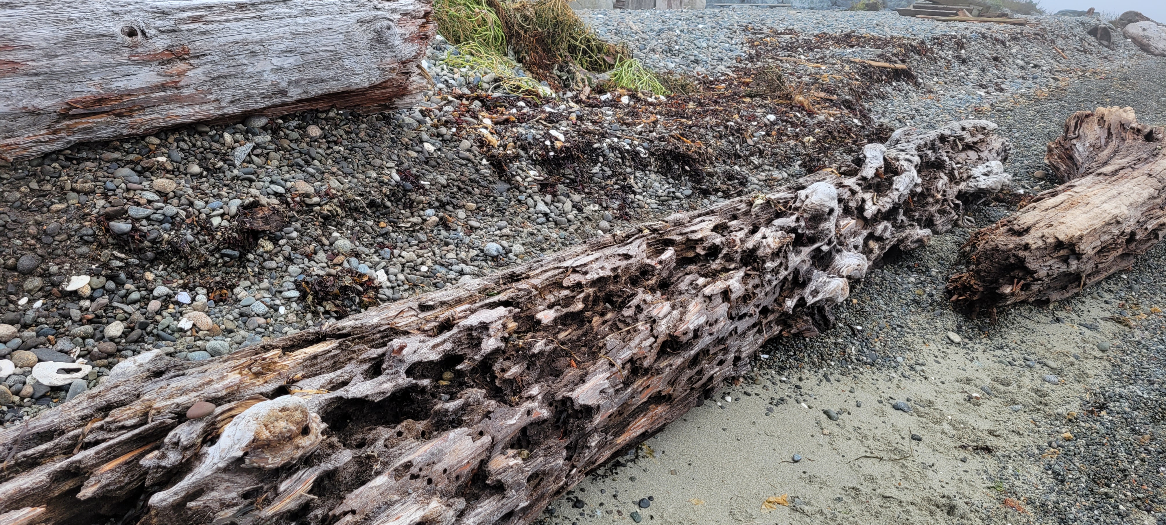
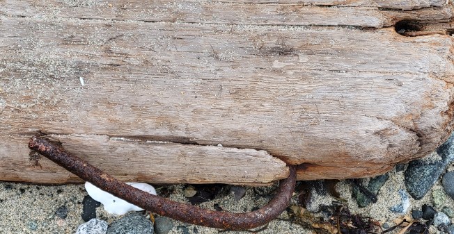
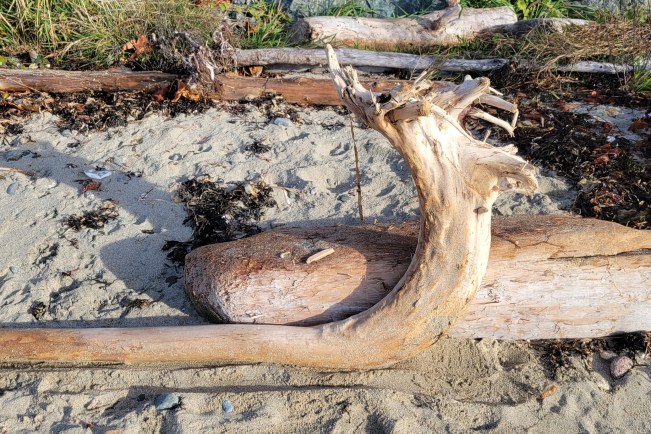
Folks who live in seaside towns are very fond of driftwood. Driving along coastal roads you see artful root clusters displaying house numbers. Flowerbeds are bordered by curving logs, fences constructed from salt-weathered timbers. It inspires us to rearrange our small domestic landscapes to display its surprising shapes, to fill its cavities with garden ornaments or tiny succulents. In a small way, it illustrates our desire to bring the wild, the feral into our domestic spaces.
In his wonderful book, Wildwood: A Journey Through Trees, Roger Deacon’s chapter on driftwood begins with a climb up the stairs to Margaret Mellis’s studio in Southwold, one of the most easterly English communities on the North Sea coast. Towards the end of her long career, she began to create objects out of driftwood. Deacon writes:
Bottom of the deep blue sea
Ribbed
Everyone in Southwold used to bring the driftwood harvest of their beach walks to Margaret’s doorstep, leaving it in the front garden for her. The best of it would find its way upstairs to the studio, where Margaret separated the painted from the natural wood, the former bleached and muted by the sun, the latter chamfered, flayed or shattered by the sea.
Deacon, who also wrote Waterlog, an actual log of his year of wild swimming in Britain, comments on the relationship between Mellis, the water and the wood:
As a sea creature herself, in that she was a regular swimmer, Margaret Mellis felt a natural affinity with driftwood. She took part in its life and knew what it was to float in the tidal currents off the Suffolk coast. Over time, water imparts an abstract quality to wood by sculpting away its inessential, softer parts, emphasizing the sinews of grain until the knots stand out like inset pebbles. Driftwood maps the movement of water around it in its own grain.
The forces that bring it to our shores are often equated with violence and rage. The same power could be said to embody the great eureka moments of love, joy, understanding – likely why we are so invigorated by standing at the shore, sucking in that turbulent air, filling our blood with its chaotic energy.
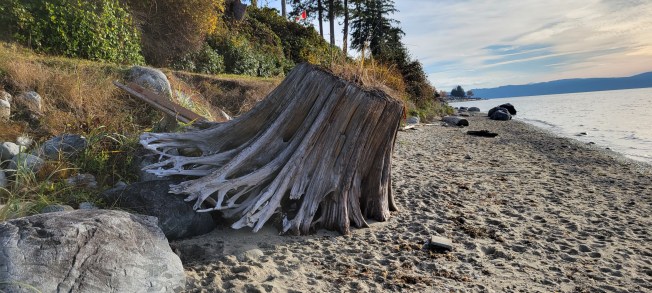
Deacon compares how important driftwood is to the ocean’s ecology to the pivotal role fallen trees play in the life of the forest. Their structures provide shelter for small animals and birds, their decay provides nutrients for all kinds of creatures. Sea and shore birds love it, ride on it, flip over the smaller bits in search of food. In the sea, small clams like the Teredo navalis or shipworm and crustaceans like the gribble worm break down the wood. Their chewing produces sawdust which adds nutrients to the ocean environment. Far from shore, small fish will congregate around driftwood because the microbes and worms it harbours provide food and shade. In turn, the small fish attract larger ones to feed on them.
Even a tree, which we think of as a fixed point, rooted as anything can be to a single place on Earth, can be imagined into a drifting nomad, nibbled by fish, wandering the oceans, ending up anywhere from Southwold to a remote beach on Hokkaido.
Or on a qathet* beach. Remote by some standards, I guess. The larger pieces that get lodged into the edge of the terrestrial world, often, in fact, protect it from the battering winds and tides. They provide very handy back rests, something to sit on or duck behind when changing out of a wet bathing suit. Children run, balancing, along their lengths, jumping from one to the next in a kind of beach parkour. I remember riding logs as a child when the warm southeasterly summer winds stirred up the water and set them afloat.
In her final years, driftwood gave Margaret Mellis a whole new way of working. It connected her to the physical place she lived and to its people. It also gave that community a way to show respect and appreciation by contributing to her work.
Whether we travel the world, or settle, wedged into a refuge of sand and blackberry vines, we are like driftwood thrown loose in the spring freshet, the rush of laughter and sorrow that make up our lives. We are everything we’ve experienced, and even as we diminish, shrink and fail, we’re returning all that we’ve been back to the world around us. We’re returning home.
*qathet is a name given to the regional district (formerly Powell River) by the Tla’amen people. It means working together. Many regional organizations have adopted this name.
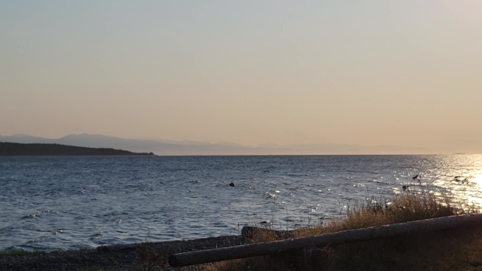
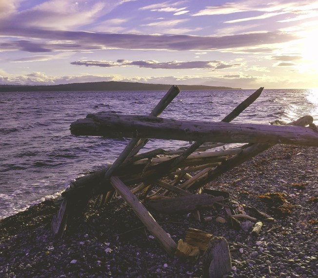
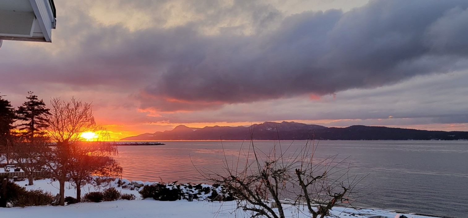
We’ve had a couple of good blows in the last few weeks along with high tides – 17.7 feet here at Grief Point, which is as high as we’ve seen it. Luckily they didn’t coincide. The wind and the tides. Still, everything has shifted. Hundreds if not thousands of logs moved northwest up Malaspina Strait over the past month. Sometimes whole trees, root clusters and branches taking the shape of mysterious vessels. Sometimes a seagull riding.
Walking our usual stretch of beach is like opening the pages of a new book – pages shining with unexpected images, mysterious conjunctions, peculiar stories. Twisted plots expose deep roots, once hidden. Massive logs block stone stairways. Oyster catchers mine the seaweed, tumbled into heaps along the tide line. The peculiar kale plants that grow in the gravel are freshly salted. Still growing.
Driftwood. Having lived for over forty years on a road named Driftwood beside a creek with the same name has focused my attention on the stories those jumbled piles contain: the seed that germinated, the soil that received it, the sunlight it processed into stems and leaves and bark, the years it witnessed, the creatures that climbed it, rested and nested in its branches, the music the wind played in its foliage. There, in Driftwood Canyon, it all originated within the few miles between the creek’s alpine beginnings and our home.
Here, beside the ocean, the whole coast sends driftwood our way. Some trees ripped out by wind, erosion or machinery. Straight cuts on the huge ones tell another tale. Men and chainsaws. Trucks on precipitous roads. The big boom logs, holes at either end to tether the others. The ones that escaped. Then there’s the lumber – wood that could have travelled the world before it arrived here. A boat torn apart in a storm, construction garbage tipped down a bank, a summer cabin bulldozed onto the beach. Decorative fences, seashore patios for viewing the sunset, washed away. The bottom step of a stairway suddenly a chasm.
Children build forts with it all.
For each scrap of wood, there was, somewhere, sometime, a tree. That one in the forest everyone questions. Whether or not we heard it fall, that scrap of cedar or Douglas fir contains hundreds of years of stories. The composting berries birds deposited in its canopy. Globe-travelling rain dripping nutrients through the lichens dangling from high branches. Traces from the salmon carcass a grizzly brought inland to share with its cubs. Calcium from the shells seagulls dropped. Everything on the forest floor adds its own note to the song the tree sings. A pile of grouse feathers flung from the owl’s roost. A mouse skeleton under an alder leaf. Someone’s old leather glove decomposing under the moss. A forgotten sandwich. A dog, lost.
Its stories are like the ones languishing in folders in my desk. Some abandoned under a tangle of blackberry vines. Others unfinished. Just resting for a few days, weeks or months until the wind and water, stirring my imagination, set them free again.
After the big wind and tides, the sand is packed hard for pleasant walking and the beach is a library made new. Old favorites, brought out and dusted, seen in a new light. New arrivals, waiting for our imaginations to open them up and make their stories part of our own.
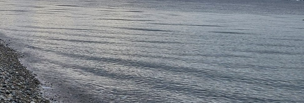
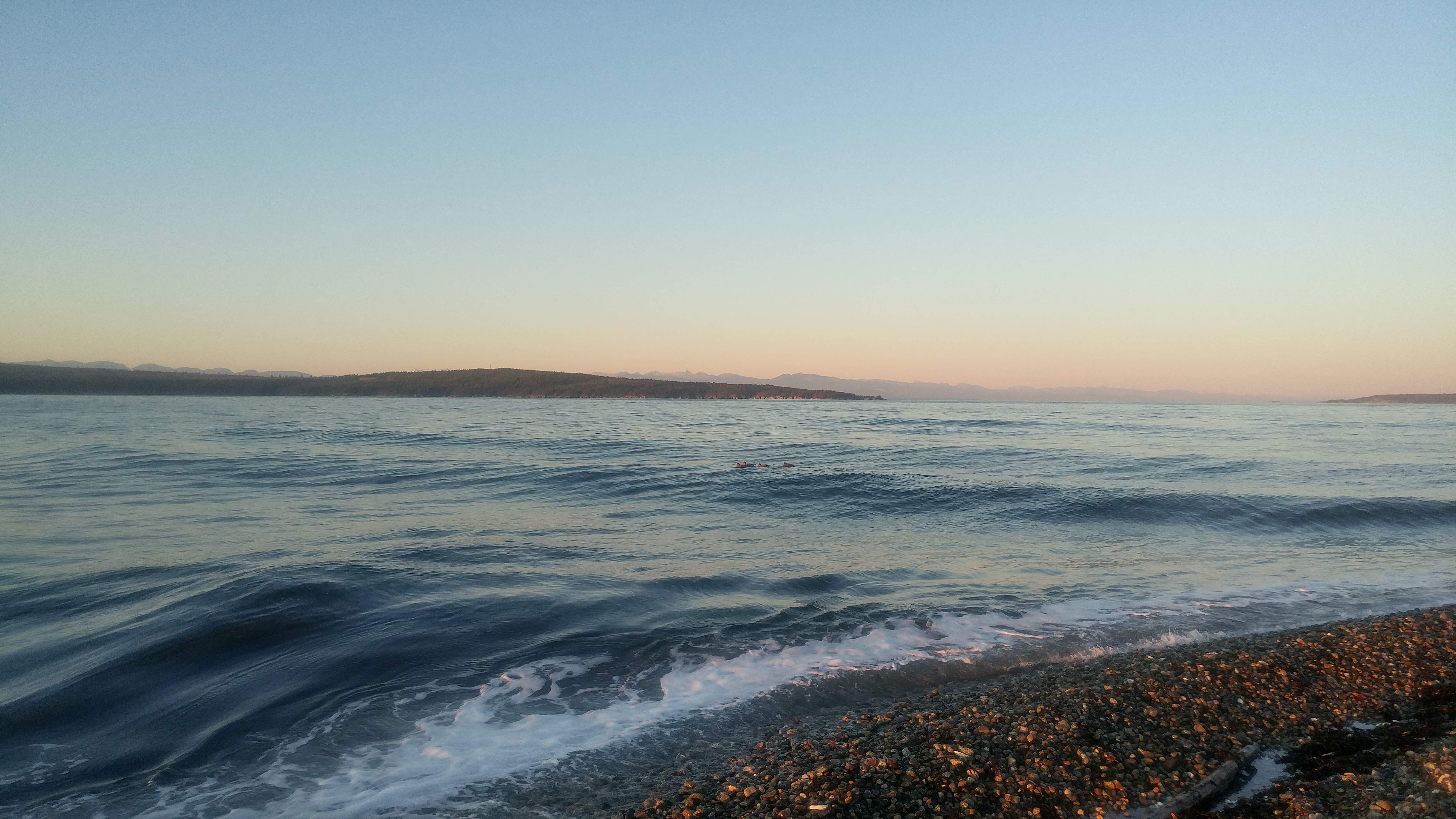
Suddenly, sunrise. Light streaking across the water, a moment of colour and then the silver of mercury. All these shrinking days, the light angling lower and lower, the water turning and turning under the sky as if alive with creatures stretching their bodies toward the light. A living layer of sinuous and sensuous curves catching the brief brightnesses under winter clouds.
Trying to make sense of it, to see the patterns, takes a lifetime. They mark the trajectory of the planet itself, rolling under the great rising and falling wave of the tides. The tug of the sun and moon. The currents. The wind. Often right here, creating a hullabaloo in the downpipes, on the water.
Occasionally distant winds set waves down the fetch to come ashore, noisy where the flags hang limp. The turn of the point itself, an obstacle with submerged diversions, creates eddies and refractions.
Sometimes a layer of water moves across the ripples, a smooth, flattened line tracing some invisible trajectory, some invisible desire, some secret momentum. A stream crossing the currents that pull the strait in its customary path.
And then there’s a moment when it all stops. The water and the shore sit side by side in the great theatre we inhabit, one as calm as the other, unruffled. And you look through to pebbles as clear under the water as they are under your feet. A sea lion rises, rolls over and slips back under. A harlequin tucks it head and dives, a neat little plop. Ripples. All light, marvelous light and the shadows it creates. Movement and silence.
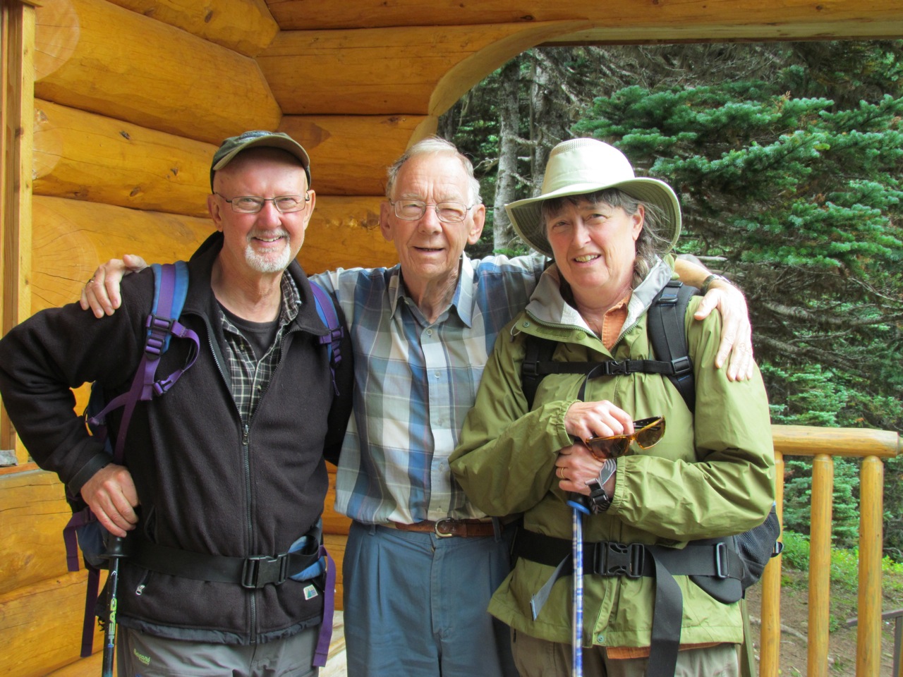
Lynn (L), Harry and Sheila at the Joe L’Orsa cabin in Silverking Basin.
When I arrived in Smithers in 1977 to begin work at the Interior News, one of my tasks was to report on council meetings. Among the colourful cast of characters sitting around the table was a low-key man named Harry Kruisselbrink. Always prepared with impeccable research and clear thinking, his quiet voice cut through the bluster and impatience of larger and more powerful men.
As well as welcoming a new reporter to the community, Harry also welcomed me and my soon-to-be husband into his and Audrey’s home. I remember watching Lynn’s forehead break out in hives after he put too much oelek sambal on his nasi goreng, the Indonesian dish Audrey made for us. Oelek sambal is still a staple in our house. Audrey also gave me good advice about transplanting seedlings, and I think about her every time I pour water over the roots of a tomato plant or petunia before piling on the dirt. Harry took photographs of our family over the years, as he did for many others, and on many a New Year’s Eve we sat at their table to enjoy olie bollen, watching the children grow, the grandchildren arrive.
Harry, always an avid photographer, took this picture of Audrey and their kids (Leroy, Juanita and Charmaine) with us in our newly-acquired back yard in Driftwood Canyon in 1977 or 1978.
Harry’s partnership with Joe L’Orsa began a long connection between the locals and those of us newcomers who wanted to protect what we all valued about the Bulkley Valley. Lynn had coffee almost every morning with Harry during the years he worked at Interior Stationery and the Telkwa Foundation and we worked together on many environmental campaigns to save the Bulkley from Alcan’s plans to re-route upstream rivers, to protect the Babine Mountains, to stop Telkwa’s coal deposits from being exploited.
His keen interest in history got him to conscript Lynn to write the seminal history Smithers,From Swamp to Village to celebrate the town’s sixtieth anniversary. Harry provided many of the photographs.
Harry also played a pivotal role in my fledgling forays into writing. My first published short story featured a young man delivering telegrams, a job that gave him a window into the secret life of a small town in the fifties. I tried to create a sense of Smithers back then, how the railway and the telegraph lines it carried were at its centre. Harry’s willingness to share his own work experiences grounded that story and taught me much about place and connection, how apparently unrelated events draw people together or set them apart in ways we might never imagine.
The collection of short stories in which “Delivery” was published illustrated the environmental link further. Efforts to slow down logging in important habitat resulted in a visit from a Montana economist; he talked about how small towns were often torn apart by resource extraction projects that come and go, leaving the locals Tending the Remnant Damage. Harry took the cover photograph.
Research for more stories led to many conversations in Harry’s office in the old CN station (now Trackside Cantina) surrounded by the walls of batteries, wires and flashing lights used to run the CNCP telecommunications network he helped maintain. One of the central characters in Shafted, a mystery published in 2014, combined Harry’s love of the outdoors, his environmental ethics and that deep rootedness in the town with his past as a telegraph delivery boy.
I need to say that the characters in my stories are nothing like Harry, but his willingness to share his own past gave me a great gift to build upon. Harry never seemed to worry about people thinking he might have been thinking my characters’ thoughts. In fact, he seemed tickled by his contribution.
Harry with our son, Michael, and Richard Overstall, another long time member of the cohort of environmental activists in the region who worked beside First Nations in their fight for justice. Pat Moss, who took this photograph at the launch of Shafted, is another.
Over the years Harry continued as a friend and a strong voice – always willing to say what he believed with clear evidence for those beliefs. He brought that clear thinking and tolerance for disagreement to the last Creekstone Press project we worked on together. Shared Histories: Witsuwit’en-Settler Relations in Smithers, British Columbia, 1913-1973feels like a bookend to Swamp to Village. Harry was part of a committee that worked with the author to present another kind of history by connecting Witsuwit’en stories to those of the town’s settlers. Harry’s memories of Smithers through his own long residence and his patience and understanding as we all struggled through a very difficult process was integral to the book’s completion. Plus he was the best damn proof-reader an editor could ever hope for.
It seemed especially fitting that the book’s author, Tyler McCreary, was the grandson of one of the councillors sharing the table with Harry back when I began reporting.
The people who love Harry and have benefited from his contributions come from all parts of the community. His example of how to live in a small town, how to bridge our differences, brings us all together. We will miss him terribly.
We’ve seen the harlequins and other ducks returning from their summer breeding grounds to the ocean in front of our house. When we lived in Smithers, we’d see them in the spring, the harlequins chugging up the turbulent melt waters of Driftwood Creek on their way to nest in the alpine meadows of the Babine Mountains.
Here in Powell River, the small creeks drain watersheds that begin and end within a short run to the ocean and don’t offer much that harlequins seem to need for breeding. But they do offer what many children need and love. Moving water to splash in, to fill their boots, to float their pea pod boats and dream of bigger voyages.
Squatter’s Creek, the creek of my childhood, did that for dozens of kids, especially because for a few short years it ran across the southeast corner of the J.P. Dallos school playground. My mother, Betty Anderson/Peters/Berger, taught there from about 1956 until she moved to J.C. Hill (now the Music Academy). She likes to tell of a six-year-old named Victor being very pleased with himself when he produced two or three little fish for her after a recess fishing expedition.
My sister Susan and several of her classmates remember when their Grade One teacher, Mrs. Winegarden, had them write the word Can’t on little pieces of paper and troop down the steep bank to the creek to send the word downstream; they were encouraged to never use the word again.
Susan’s friend, Judy Thompson, wrote, “I certainly do remember the creek behind J.P. Dallos and we did play there on weekends as well as sometimes ‘illegally’ at school! The kids were always getting into trouble for playing at the creek and it did flow quite fast at times … it used to flow right past my Auntie Connie and Uncle Bob Lyons’ property on Westview Road. We just took all that for granted … I remember the water was quite clear …”
In those days, both branches ran clear.
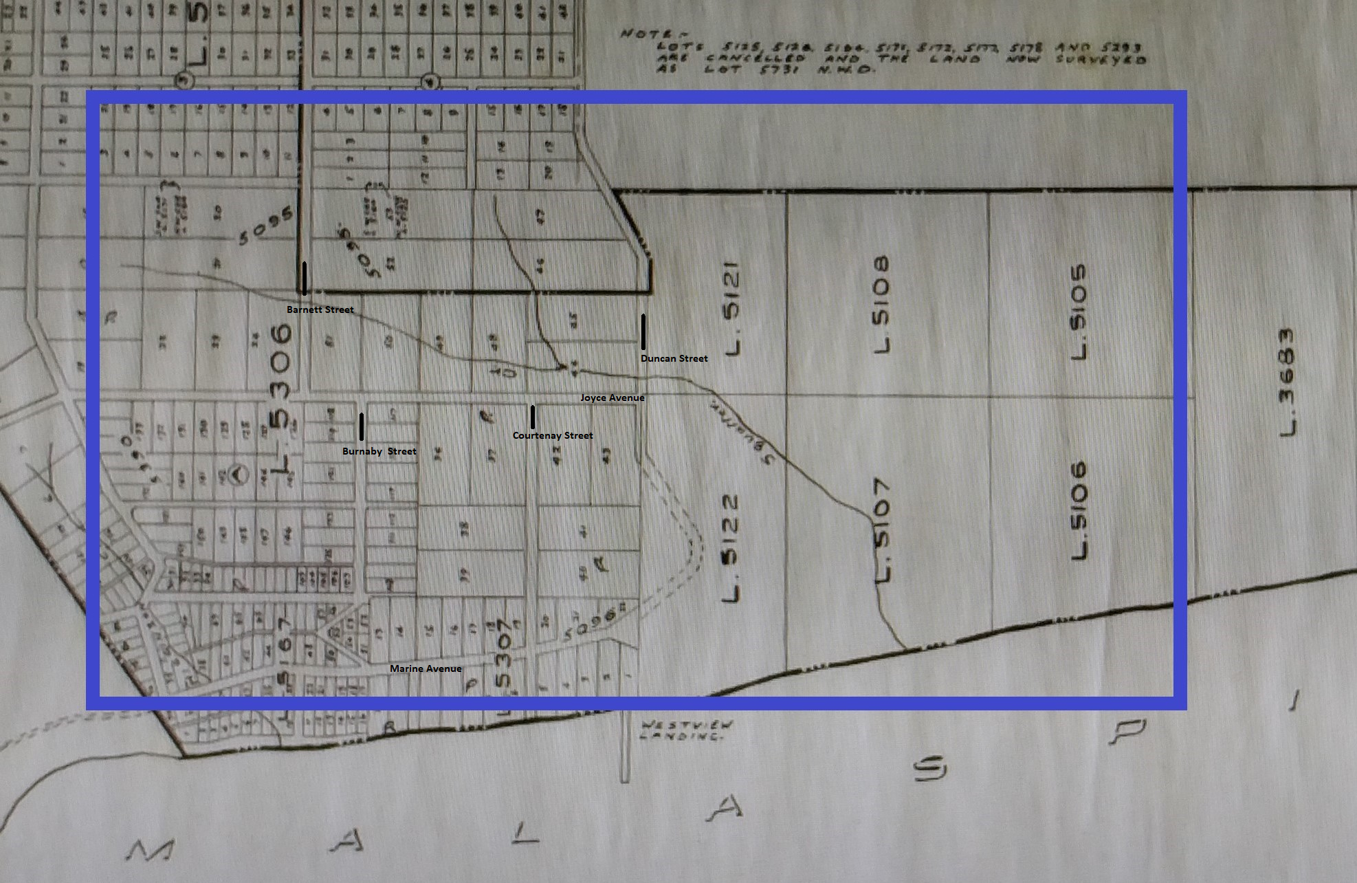
This 1931 map shows the two branches of Squatter’s Creek joining above Joyce Avenue just east of Courtenay Street before crossing Duncan, Joyce, Westview and Marine, entering the ocean where the sea walk begins today. Map courtesy of the Powell River Historical Museum and Archives 2013.63.5 Westview Light Power and Water Works District 01/10/1931
Stewart Alsgard remembers playing and swimming in it when he visited friends who lived beside it near Joyce and Courtenay. The Tom Pickles family moved onto seven acres of land above the creek just west of Duncan in the late 1940s. Tom Jr. hunted, fished and trapped in the bush around his home throughout his childhood. He remembers crossing one of the bridges (likely over Joyce) when he was coming home from visiting his friend Glen Husband down on Westview Avenue (see Boxwood Gardens below). After dark, he said, he’d run like crazy because there were deep shadows under that bridge and he imagined trolls living there. He also told of the time he and his friends decided to create a swimming hole on the creek above his house. They built a dam that included stakes, logs and sandbags. When he caught wind of it, Tom Sr. made them tear it apart – it was holding back quite a bit of water and could have flooded the houses down below if it broke.
By the time we moved to Quebec Avenue (1957) some of the creek had been piped under Duncan and Joyce; we had to go through Pickles’ property to get to it. My brother remembers walking there as a five or six-year-old, having been given a hatchet to protect his mother and a friend from bears. Later, I’d follow him to balance on logs and peer into their shadows in search of trout. Slow, silent movement was essential to not spook the fish.
The creek was supposedly named after “squatter” William Joyce, whose property it ran through. Joyce was, however, no squatter. According to his granddaughter Mary Carlson (nee Douglas), who came to live with him in 1931, Joyce was a pioneer of the Westview area. He had forty acres of land, which he had bought for $10 an acre. It was waterfront property; its width was defined by Duncan and Fairmont Streets.
My grandfather had 200 fruit trees, five or six hives of honey and a large garden on his property. He also kept chickens. A log house (situated on the spot where J.P. Dallos School stands today) was the main building; he later added on a complete house to provide extra space.
Squatter’s Creek ran through the property. WJ built a dam and a waterwheel on the creek; this fed through pipes to our house and others on Fourth (Duncan) and Fifth (Egmont) Streets. He charged 25 cents a month for those who wished to have piped water.
In the 1920’s and 30’s he laid out his 40 acre property into lots. He sold the water front lot for $250 for a location for the oil tanks [Andy Culos’s Esso tanks were just above the south harbour]. He sold other lots for $100.
Of course there was very little money around during the Depression years when the mill was working two weeks on and two weeks off, so he sold the lots at $5 down, and $5 a month until the $100 was paid off.
He gave approximately two acres of land for a school. The second Westview school was built on the school site, where the Municipal Hall is located today.
(From Rusty Nails & Ration Books: Great Depression & WWII Memories 1929-1945 by Barbara Ann Lambert; Trafford, 2002, pp 151 – 152.)
By 1950, instead of being a valuable resource, the creek was an impediment. When it came to building a new school, a central point in Westview was deemed the best area. A solution seemed apparent when a major portion of Joyce Farm was purchased by Powell River Municipality for parkland. The Powell River Co. Ltd. then generously provided a huge waterpipe to divert the creek which flowed through the farmland. The area was cleared, and fill was used to level the area. With completion of these renovations the remaining ideal school site was purchased by the Board, and construction [of J.P. Dallos, now École Côte-du-soleil] began. (From Powell River & District Schools: 1898-1983, collected by Alice Cluff p. 30.)
The remaining creek wasn’t fenced off and still tempted the kids to infractions through the 1950s.
Landfills
As far as I can tell, it was during the late fifties and early sixties that the creek became a convenient site for a series of landfills. I’m not sure in what order they happened. When I asked members of the Facebook page “You Know You Grew Up In Powell River” about their memories of Squatter’s Creek, Greg Coomber wrote, “they put the dump behind J.P. Dallos school and later behind Max Cameron School. Above the dump there are fish still to this day but below it is a yucky mess from all of the leaching. I used to fish in our back yard to get trout for dinner ’til they polluted it.”
Greg’s sister, Jody Coomber Turner wrote, “I remember trout when I was little, but also remember taking a jar of water from there to science class at Brooks years later. Mr. Ramsay’s class. Everyone had to bring a sample in so we could see what developed in the water. After a week, I was told I had to take mine away! It was full of long, skinny, segmented worms! That’s when there was long brown gunk flowing off the rocks in the stream! Yuck!”
Ed Dunn told about “falling in the creek behind J.P. Dallos when we use to play there. I remember when they were filling in the field with garbage, and we would grab the old 78 rpm records and use them as Frisbees.”
Bob Dice has more detailed memories:
At J.P. Dallos School in my Grade 1 (1958), the south west corner of the property was forested with trails – at recess the boys would run into the trails in a game of chase and tag – I once caught my friend, the very fast but small Bobby Rentmeister, who must have known Judo because in an instant he had me flipped over his back and on the ground. Other kids of my grade – Harvey Coomber, Wayne Rourke, Murray McNeil, John Straathof, Herb Peters. On the school’s south east corner – where the baseball field is now located – were dozens of mounds of dirt that were trucked in and dumped on otherwise level ground (maybe for the purpose of preload compacting the land which was possibly over top a garbage landfill for a future playing field?). The game the young boys played on the mounds was a very physical ‘defend the hill’ – several boys would race to be the first on top of the hill and the other boys tried to capture it. Lots of rolling and tumbling – a fabulous game that was ruined when the mounds were levelled a year or two later.
Clifford Lang wrote a letter to the editor Dec. 4, 2013 headlined, “Memories of Squatter’s Creek.”
I lived on Redonda Avenue in 1972, and always walked through to Duncan Street to Speed and Stan Toyota. I remember the smell of rotten garbage behind Adams Concrete and across Duncan where the old city bus garage was built. When Speed and Stan Toyota shop was there, there were holes drilled in the back through the concrete to let the methane gas escape. I was there getting my car fixed when that was happening.
I know Max Cameron Secondary School was built on a floating slab because of the landfill. The soccer field was always leaching methane and was wet and sloshy. It was never a good field. As a long-time resident of Powell River, I remember a lot about that area and played soccer on the Max Cameron field.
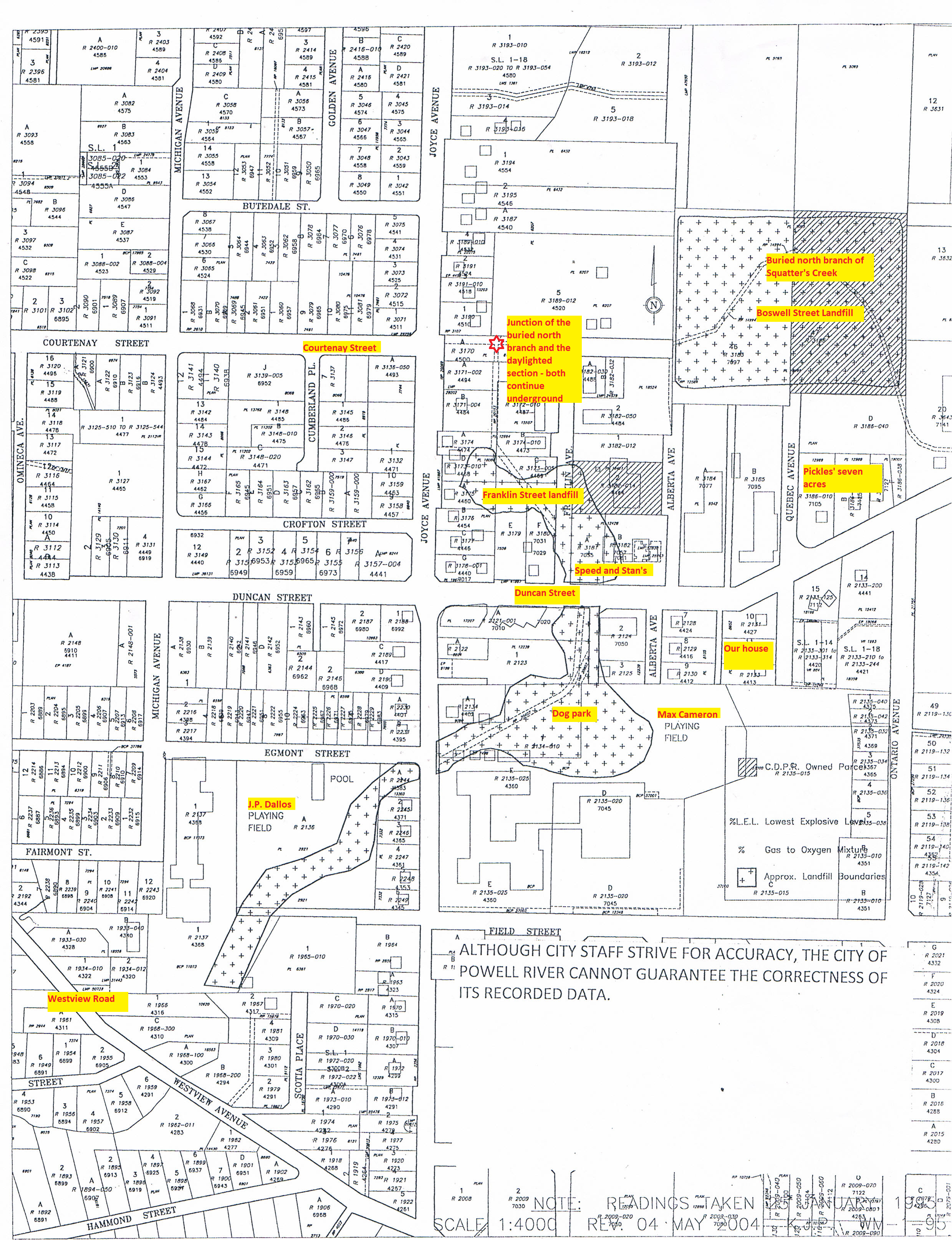
The 2004 map below shows those landfills as outlined blocks (filled in with +++). The buried sections of the creek are indicated by double lines through those blocks. The yellow blocks of type are my inserts. You can follow the north branch down through the Boswell Street block; the rest of the buried section continues through the Franklin block, across Duncan below the dog park, across Joyce and down past what used to be J.P. Dallos. I vaguely remember rummaging through the dump, but can’t remember exactly where it was. I don’t remember when they began filling in the north branch, turning it into the infamous Boswell Street dump. By 1966 we had moved to stay with my grandmother while my parents built our current home.
By 1967, complaints about rats, smoke, seagulls and smell from the Boswell dump were a major source of concern for the town, as the minutes below indicate:
January 3, 1967 Sanitary Land Fill. Mr. A. Graff, the spokesman for a large group of residents in the area of Boswell Street, expressed dissatisfaction on the present method of sanitary land fill. He pointed out that the residents in this area were suffering many hardships as a result of seagulls feeding on the garbage and depositing droppings on the houses, cars, clothes, etc. Dogs and cats were also congregating at the dump and feeding on raw garbage. Rats were also noticeably present in the surrounding area. After each member of the delegation was given sufficient time to ask questions, Reeve Pike expressed the opinion of Council. He pointed out that the Municipality had recently purchased property in the area of the previous sanitary land fill and, just as soon possible, the Municipality would enter onto the new property and the present dumping area would be abandoned. After the municipality have moved to the new area, the property owners in the area adjacent to Boswell Street will be consulted regarding damage that may have occurred during the time the land fill was located in the Boswell Street area.
The new area was, I think, not far downstream:
Reeve S. A. D. Pike stated that a property owner had volunteered the use of a gully on his property on Duncan Street for use as a sanitary land fill site. The Municipal Engineer was instructed to approach this gentleman and have this offer officially confirmed in writing.
Subsequently, the offer was accepted:
Letter from Mr. C. F. Cheshire regarding sanitary landfill on his property. Moved by Councillor J. Court seconded by Councillor R. J. Tucker that an agreement be drawn up between the Municipality and Mr. Cheshire regarding sanitary landfill on Mr. Cheshire’s property. Carried.
Cheshire’s property was near Franklin Street where it crosses Duncan. But I haven’t figured out exactly when the different sites were in use. Bob Dice remembers his friend Murray MacNeil, who owned a pellet gun: When we were ten to twelve (1964 est) he invited me on an interesting rat shooting party at the landfill at the end of Franklin Street. Murray scored a couple of kills.
The Squatter’s Creek landfills have come back to haunt the city. Gino Francescutti, an engineer with the municipality for many years, confirmed Clifford Lang’s story about Speed and Stan’s. They noticed when they dropped tires from the storage spot in the rafters, the floor bounced along with the tires. Drilling down, they found high levels of methane; the fire department was brought in to seal it off. It had to close down because of dangerous landfill gas emissions getting into the building through cracks in the cement. But when people were ready to sue the town, Francescutti went down to the old archives in the basement of Dwight Hall and found a report from Mac Campbell, Powell River’s first municipal engineer. The method he proposed (clear the bank of the chosen ravine; dump in the garbage, burn it, repeat) was state of the art garbage disposal for the times. When Campbell submitted the plan to his professional organization, he received accolades. So lawsuits were off the table.
But those plans have left several sections of city land unusable without major reclamation costs and continue to cause difficulties.
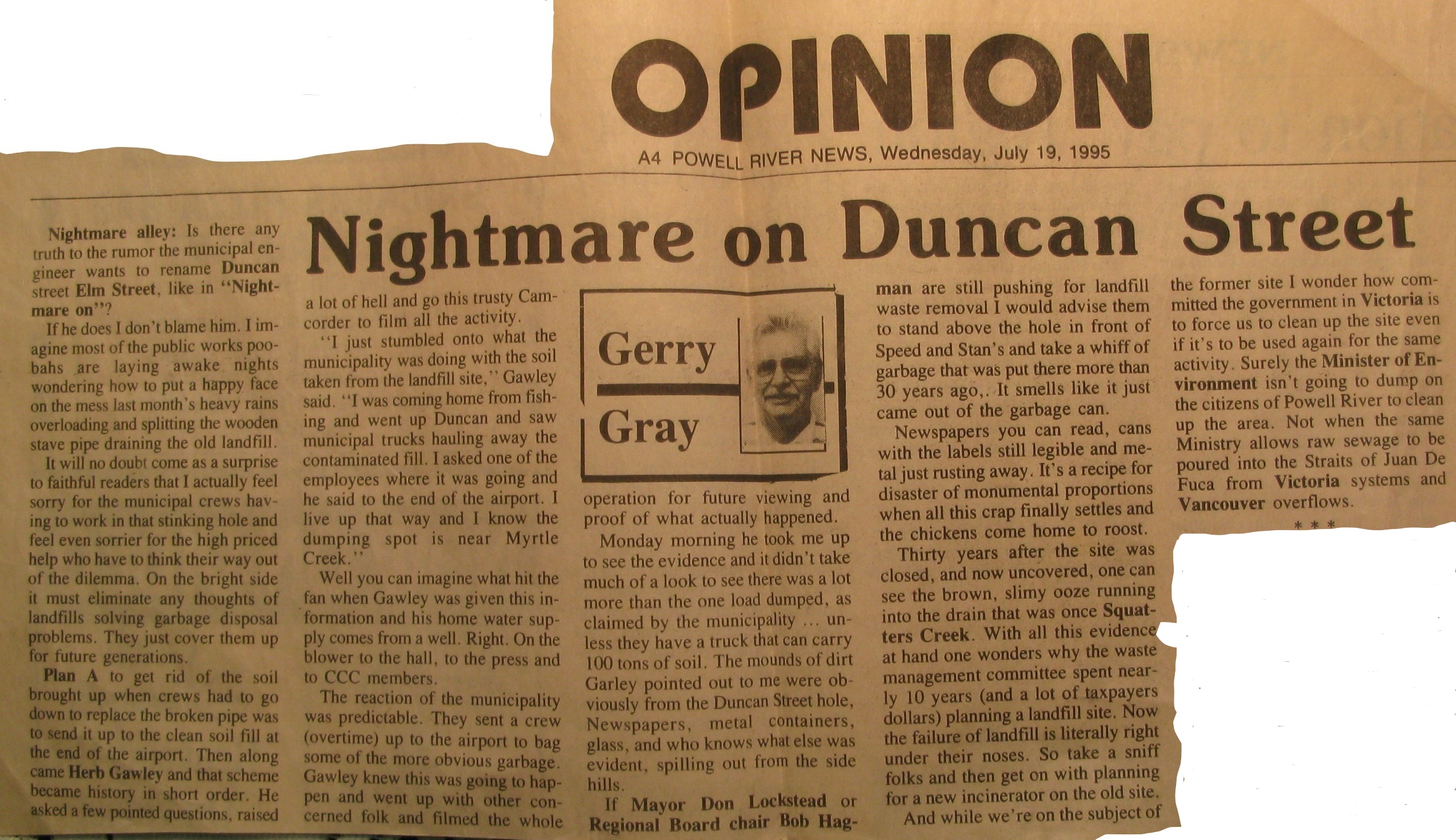
Bob Dice kindly shared much of his father’s archives about the creek. It included this 1995 article from the Powell River News.
It still goes on. This from Bob Dice: Around 2015 a sink hole developed on the J.P. Dallos grounds near Egmont and Joyce property corner– the sink hole was cordoned off – Herb Gawley and my dad assumed that the Squatter’s Creek culvert was leaking.
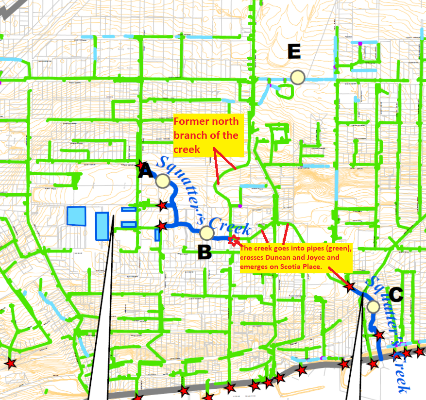
There isn’t much of Squatter’s Creek left above ground, as the map below illustrates.
The blue lines are the daylighted portions of Squatter’s Creek; the underground sections are traced in green; our old branch entered just where the upper daylighted section goes into the storm sewer. (Westview Watershed Drainage Master Drainage Plan, 2007: Drainage Overview Figure 3-1.)
Today, the creek above Joyce and below Joyce are entirely different watercourses.
Upstream
The western branch, which once drained swampy land east of Alberni Street, now drains the runoff from the various parking lots of the Town Centre Mall, Hotel, and apartments. The daylighted section of creek just downstream collects water from those parking lots, mixes in a little spring water from further up Barnett and runs along just above Joyce until it enters another storm sewer behind the Salvation Army. That water is pretty clean and still supports a small trout population with attendant raccoons and blue heron.
Last spring my brother and I went to check it out. On our first trip, we entered from behind City Transfer’s back lot. The edge of the bush had all the hallmarks of such places in the middle of towns everywhere. An abandoned grocery cart, a bulldozed pile of old lumber, a few plastic bags.
But once we passed through the transition, trails appeared.
We both tried to feel our way into it, to remember the feeling the forest gave us, but it didn’t happen. The creek is buried, and the distance created by the lives we’ve each lived in those fifty years have, at least for me, erased all but a very few sensory memories.We followed the trails over to where the upper section of the daylighted Squatter’s Creek curves around the edges of parking lots and backyards near Barnett. We found one tent near a grassy opening.
The bush was tidier than expected – we’d heard people partied in there but there was very little garbage. A few days later we went back in to try to further trace the creek’s passage, entering right behind an apartment block on Joyce and met Michael Gelber, one of the reasons there’s very little garbage. He lives at the top end of the bush on Redonda and walks it pretty much daily with his dog, Arena. When we met him, he’d just moved a cracked safe out of the creek – likely a stolen one that had been carried out of sight before being broken open.
He took us up the creek, pointing out the culverts that spout out of the parking lots, and along the top end where water seems to seep out of the ground. He explained the different plans people had made for the mixture of private property and town lots: apartment blocks, a new firehall, and the bike jumps, well-used before the bike park was built beside the rec complex. And yes, there used to be a homeless encampment in there before the qathet Supportive Housing building was opened at Joyce and Harvie.
A few days later, Herb and I went back in with our gumboots, ready to trace the creek down to its lower culvert. It was both enchanting and disheartening. The creek made some nice sweeping curves with sandy banks and we found racoon and heron tracks, the heron tracks supporting the claims there are fish in there (we looked, but didn’t see any).
But as the creek turned to run along behind the houses on Joyce, it was a tangled mess. Blackberry vines, rotten bridges, garbage, old fences, some falling apart. But there are still signs of children playing there, even a kind of zunga.
And then it disappears into a culvert behind the Salvation Army.
We followed a muddy path up into what seemed an industrial wasteland of abandoned equipment, chain-link fences, and cracked pavement at the end of Franklin Street, much of it part of the old MacIntosh & Norman site. A few offices tucked into corners of what looked like vacant buildings. A spooky apocalyptic film set in the middle of town.
But those initial impressions are wrong. We took some friends through there last week and ran once again into Michael Gelber and Arena. He talked about how wonderful it had been in the summer to see kids playing in the creek. We wandered through the MacIntosh & Norman site and met up with Jordan Arnold, who owns it now. He is, he says, slowly cleaning it up. His mother lives on the other side of the creek and he built a new bridge across so he can pop over to see her. Sometimes pausing to let the bears that enjoy this refuge pass first.
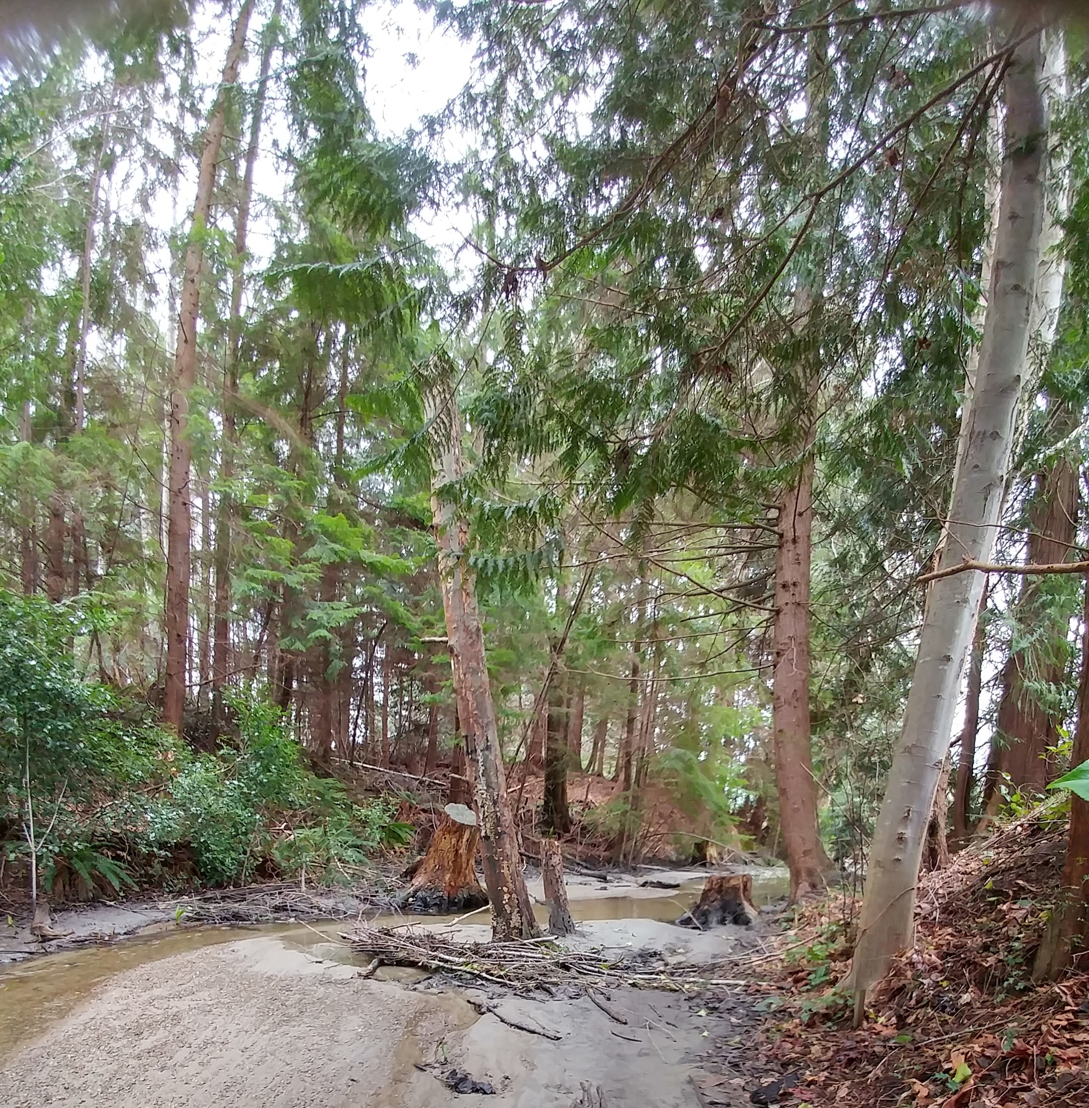
Downstream
Downstream, Squatter’s Creek emerges from the storm sewer just below Scotia Place into the same ravine my sister scrambled down with her little piece of paper. It’s the storm sewer that collects the water flowing under the old landfills and is no longer clean. Ironically, it is this stretch of creek that is much more picturesque. Just before it crosses under Westview Road, it passes through Diana Woods’ lovely Boxwood Cottages and Gardens. Our son and daughter-in-law stayed there when they got married three years ago; it’s a wedding photographer’s dream.
Diana showed me around her place last spring.
Boxwood Gardens in April
The April flowers were in full bloom, blossoms falling from the big flowering cherry tree, birds singing. The gardens flower year round, she said: the camellia blooms in November, December and January and the daphne comes into flower in February. After that comes the riot of spring. And the creek sound is everywhere.
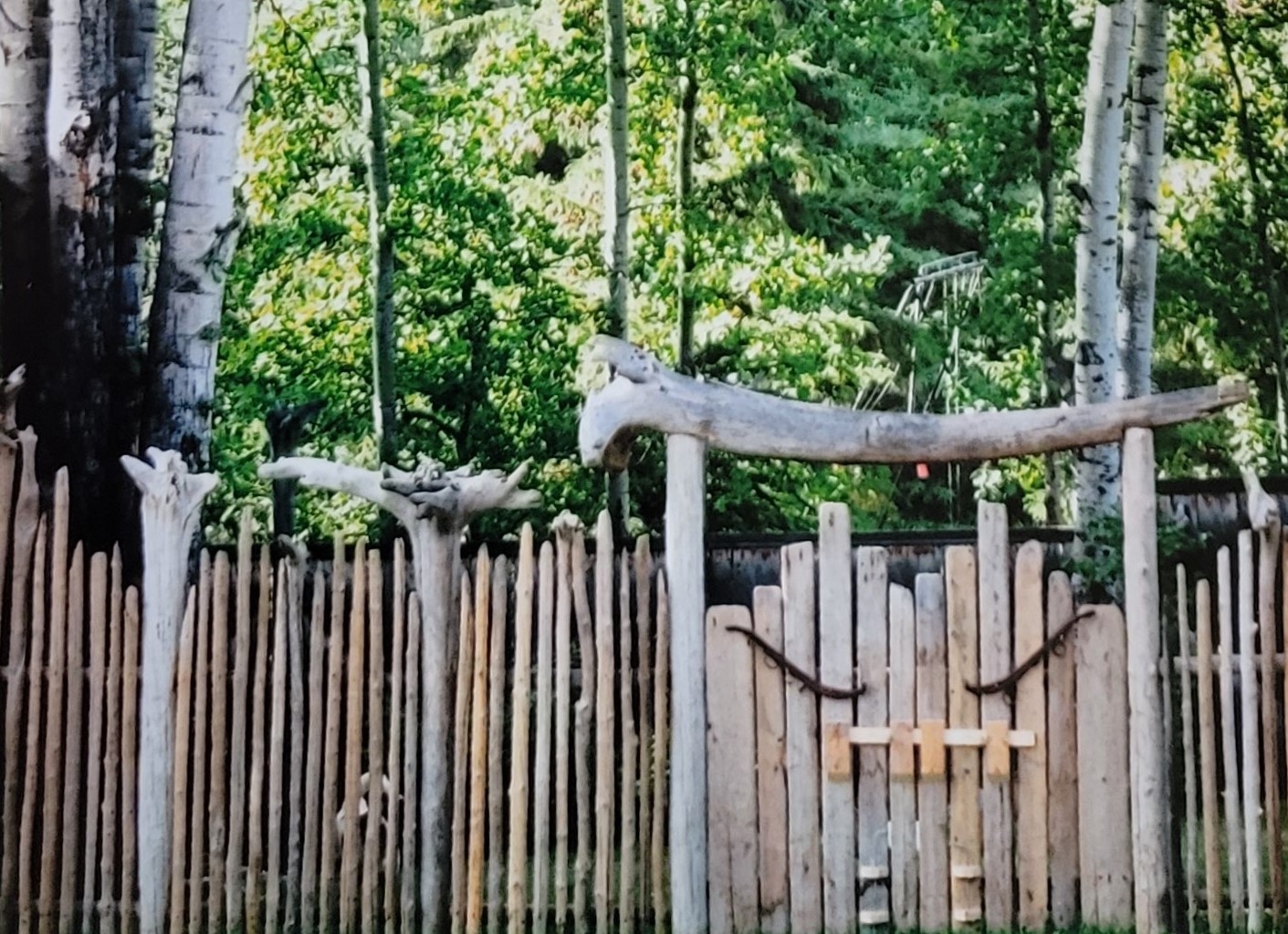
The gardens are a work in progress, as all great gardens are. Gorgeously placed shrubs, stone walls, fences and flower beds don’t hide the implements used to make them, a gas can for the mower, shovels, a rake. Diana likes to use the things she’s grown. Cedars planted years ago are now the posts used to build a small bridge over the creek with a path up to a meditation building. Bamboo canes cleared from overzealous spreading have been used to make a beautiful deer fence around her vegetable garden.
Diana in her vegetable garden.
Her house was built by Glen Husband’s (Tom Pickle’s friend) parents in 1932. Diana moved nearby in the early eighties and became friends with Mrs. Husband. “I had a good feeling about her.”
But it was the creek that drew her to purchase the property from the family in the mid-eighties. She tried to cut a path through the mass of blackberries and alders down to the creek but had to bring in a backhoe and excavator. She worked with the operator – he’d dig and she’d haul out the enormous blackberry roots. “I’m not afraid of machinery – I studied landscape at UC Davis in California,” she said. They had to build terraces down to the creek so they could get out all the garbage including a bed frame and car doors.
She loves the sound of the water, but Squatter’s Creek is not without its challenges. She had the water tested by a friend who said the water has a thousand times the amount of iron that’s safe. The sand beside the creek and the water itself often runs red. The smell is sometimes bad. When she contacted the Ministry of the Environment, she was told it would eventually clean itself out. To dilute the concentration, Francescutti told me, the town actually re-routed some of the contaminated water underground and diverted some cleaner storm sewer drainage into the current creek bed.
Just before the creek crosses Marine to plummet down under the seawalk and into the ocean, another home has incorporated the creek into its garden with a small bridge crossing.
When it finally enters Malaspina Strait the creek creates brackish pools much favoured by preening gulls, ducks, ravens and crows.
I realize I’ve been trying to give this creek heroic proportions. It isn’t like Driftwood Creek, the creek I used to live beside, with its dozen bridges, mining claims, farms, salmon, dippers, harlequins, frozen pathways for skis, home to fossils, berries, creek walking.
As Tom Pickles said when he and his wife Shannon walked through the bush there with us, it is pretty small.
My brother, Herb (left) and Tom.
But it’s got such possibilities. Perhaps development on the upstream part will incorporate the park-like qualities of the trees, the sweep and slide of the creek itself, or will make a small linear park for people in the neighbourhood. Perhaps one day the iron and methane leaching out of the old dump sites will be done and the lower creek can run clear again. There are many pieces of bush throughout town, some have been there as long as I can remember. Neighbourhood kids and wildlife make paths through them and find shelter there. The millennial trails have two fine little creeks running through them. But this stretch of woods right in the middle of Westview, with its tiny creek, feels like something worth cleaning up, worth hanging onto.
Further comments:
My sister shared some more memories after reading the post:
Right next to where the Moran’s lived in the little house below us, there was an area with lots of scrub and small trees and I remember I used to go and sit under the canopy of alder leaves and branches beside what must have been the remnants of an old beaver dam. There was a little bit of a stream bed or pond bed … about 4 feet long … in the land and although no water was moving or visible most of the year runoff water would collect in it in the fall. It felt like a magic place to me. I always felt very safe there and the moist air made me feel so good.
It may have been a water way that ran into Squatter’s Creek which would have been directly below it behind the old bus depot.
I can not remember if it disappeared when they cleared the Max Cameron field area or when they built the house next to Moran’s place when I was in my early teens.
John Mee also added a beautiful word image – thanks John.
We lived on the corner of 5th [Egmont]and Michigan before J.P. Dallos school was built, so Squatter’s Creek was a very big part of our everyday activities. I remember the three bridges in our area, the one on Duncan Street which remained standing long after Duncan Street culvert was put in and the new road was complete. The second bride was located on Joyce just south of 5th Street , the third bridge was located on Old Westview Road in front of Bob Lyons family home. Fish were abundant and trees were filled with birds and squirrels, yes even flying squirrels and large red-headed [pileated] woodpeckers. It boggles the mind how city officials would come up with an idea to fill this beautiful stream with garbage.
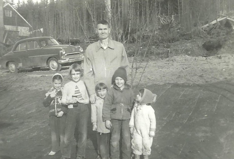
My dad stands with his hand on my shoulder in the front yard of our new house. That’s Charlie and Fiona Kirk’s house in the background. Sharon Kirk is on the left beside my sister Susan. My brother Herb is on the right beside Joanne Kirk, who’s looking up.
In 1957, when I was three and a half, we moved into our new house* on Lakewood Avenue, now Quebec Avenue, in Powell River. (My mother still has the same phone number I memorized as a child, and it is once again mine.) Our street was a sandy lane, really, with bush on the top side. If you look closely at the photograph above, you can see the darkness of the big conifers beyond the alders. Huge trees – Douglas-fir, hemlock and western red-cedar – and luscious moss underfoot. It was, for us kids, paradise.
Flanked by the curving arms of that forest above our house, we could look through the big window above the kitchen table down toward the square kilometre of our whole world: the corner store (Fairweather’s), elementary school (J.P. Dallos), church (Westview United), our grandparents’ place (Omineca Avenue) and a quick scoot down past the bowling alley and the Westview Hotel to my aunt, uncle and cousins’ house right above the harbour. We didn’t own a car until 1960.
My brother and I in front of the new house – you can see the big kitchen window looking toward the ocean.
To the east, sand banks and the frog-filled drainage ditches beside the brand new Max Cameron High School playing field. The Super Valu grocery store, liquor store and drug store at what was then the town’s only shopping mall. Across Duncan Street to the west, the Pickles lived on seven acres of bush in a house with oil lamps, gravity-fed water, and a wood stove. They had a big vegetable garden and chickens. A creek ran through their property. With trout. We didn’t know it was called Squatter’s Creek. According to the BC Geographical Names office, the name was “Adopted 2 November 1950 on 92F as an established local name and as identified in the 1930 BC Gazetteer. Apparently referring to a man named Joyce, a squatter on this creek in what is now surveyed lot 5122.” (More on this in an upcoming post.)
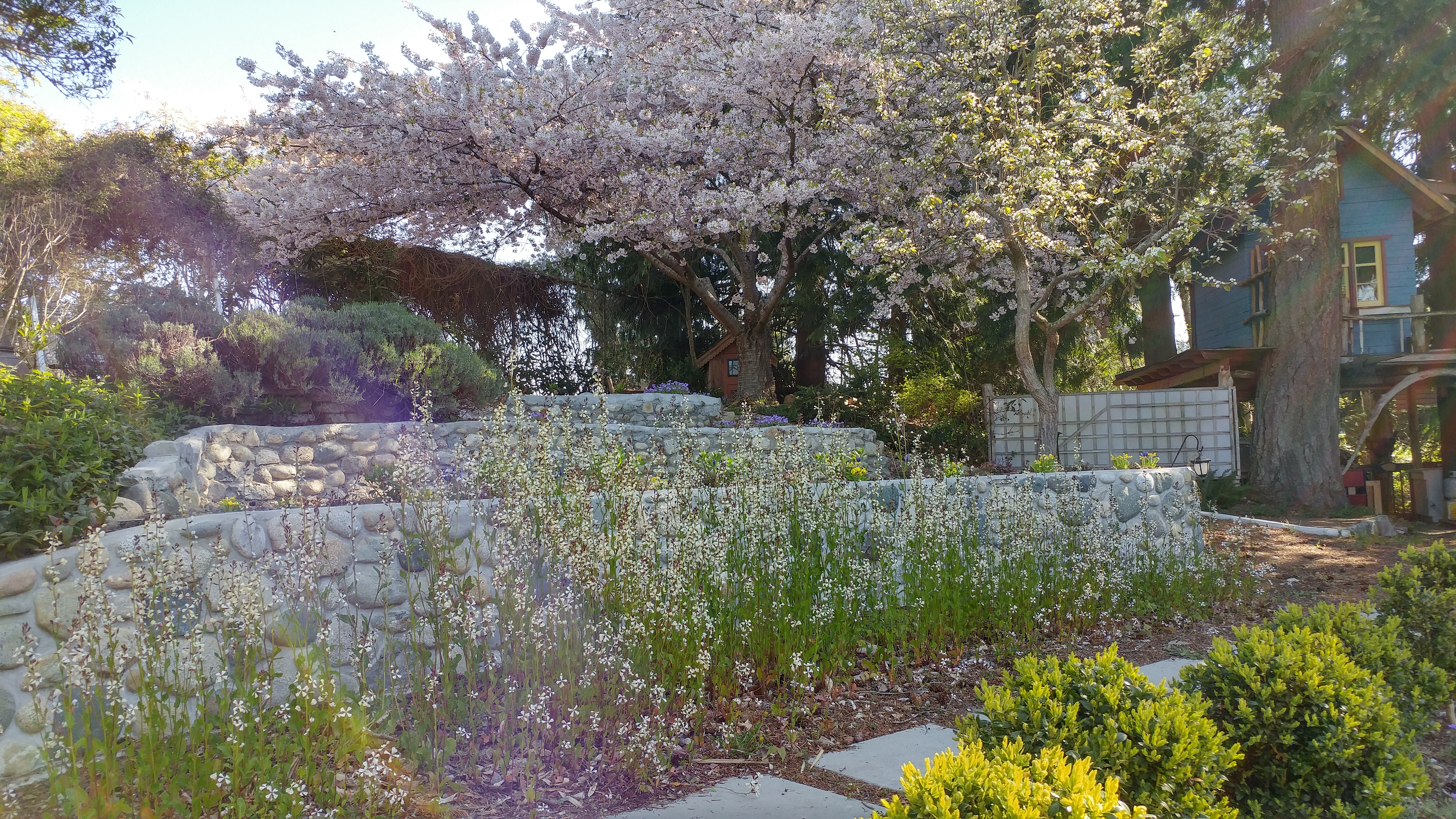
Flowering currants, an early sign of spring.
We lived in the watershed of that creek. Flowering currants to pick in the spring and bring home to Mom. Red huckleberries on a bountiful bush growing out of a huge stump on Pickles’ property. Below them on Duncan Street, City Transfer (in its former location) where my brother and I would pull our wagon to cash in pop and beer bottles for two cents apiece. In the dimness of summer evenings we’d play in the musty smell of the empty wooden trailers lined up along loading deck. Below that, Goffin’s Lumber yard where we were told of the danger of stacked lumber falling and crushing unwary children.
Everything was in a fluid state and our games shifted with the shifting landscape. We spent what seemed like several months playing rocket ships, the control deck a massive root pan in a tangle of fallen logs, from which my brother had to pull out my blonde doll in her blue satin gown with his fishing rod. Was it clearing for Max Cameron, which was built about that time? Or making way for the dump, which appeared beside it? When our neighbours, the Kirks, cleared a couple of acres, the bracken ferns made fabulous spears. Badminton on our lawn. Apple, plum and pear trees. Sorrel seeds gathered to store in the make-believe pantry I hid in a sandy opening in a bank created by some other building project. Perfume made of steeped pine needles. Tadpoles lovingly housed in a tub set deep in the moss – and the damn things always disappeared just as they were getting interesting. I never observed the magic moment when their tails fell away and they were fully realized frogs. Duh. Trying to grow carrots in the sand beside our house. Afternoons spent leaping off the sandbanks, feet usually bare. Struggling to learn to ride a bike on our sandy road.
Sand was what our houses and our playgrounds were built on.
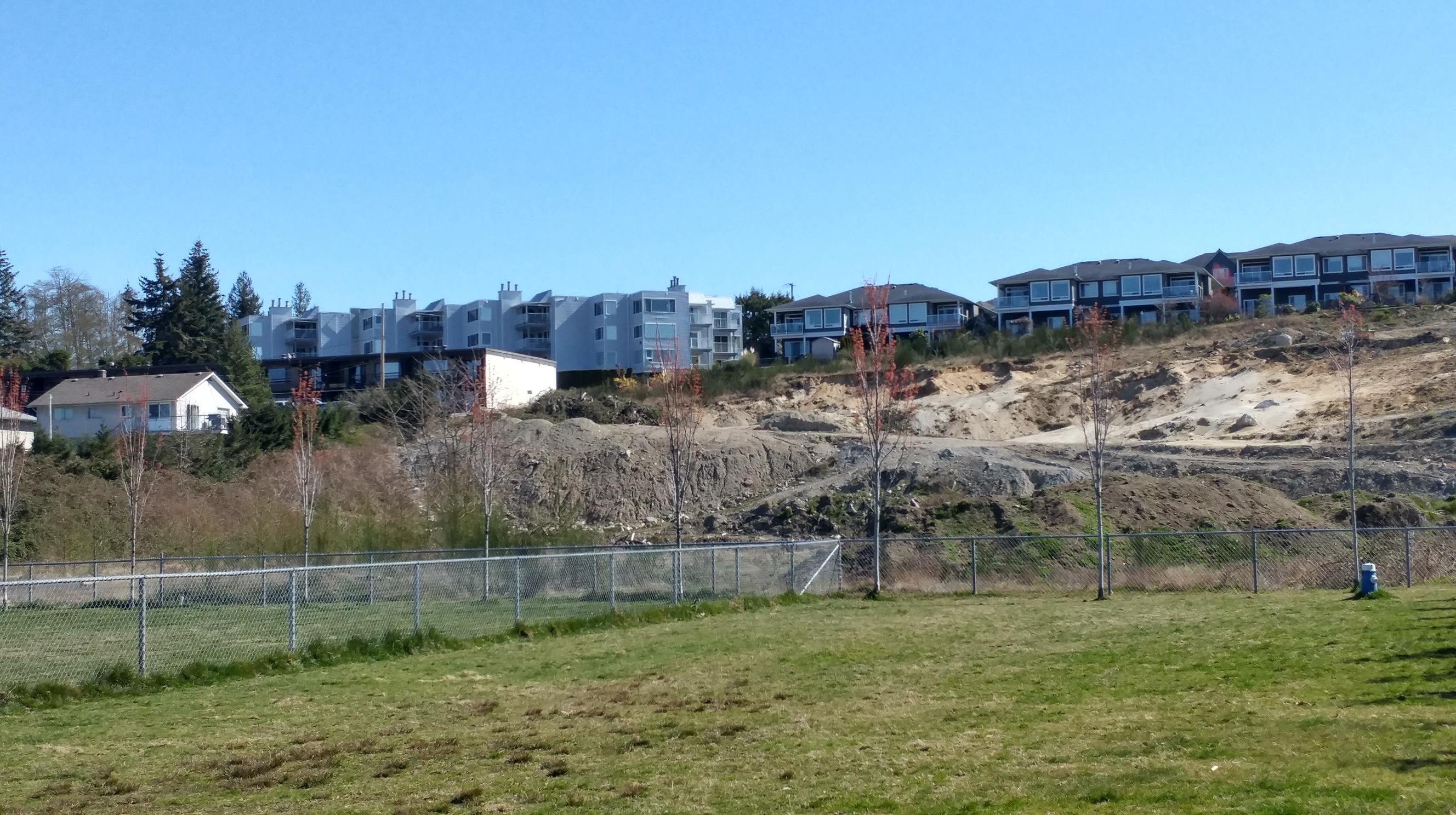
The sandbanks are still there; in the foreground, the dog park built on top of one of the nearby dump sites. Our old house is just outside the photo at the far left.
The day I woke from a dream (it must have been 1963) thinking nuclear war had begun and how could Mom be brushing her hair as usual, making the radio go all staticky? The siren at the city hall, just across from our school. The Comox air force base twenty short miles across the strait.
I rarely went into the bush alone. But I remember the creek, the way it twisted and turned, sandy bottom, logs forming shaded recesses for the trout my brother was so interested in and would sometimes bring home to eat. Bridges to balance on. We must have played on a stretch that was just a couple of hundred metres long – I don’t remember it ever emerging anywhere – but my brother says it did. Up by Fernwood and Duncan – pouring out of a culvert, collecting water from up near the airport. That tributary of the creek is gone – buried under another dump.
I don’t think we realized it was the same creek that flowed through the J.P. Dallos playground and along Westview Road to emerge at the ocean where the seawalk now begins. Forty years of living beside Driftwood Creek near Smithers taught me to look closely at the way water moves through the land. In writing this and subsequent posts, I hope to keep exploring this first watershed of my life, Squatter’s Creek, to find a way back into the community where I grew up. Watch this spot.
Kirk’s house is still there at the corner of Duncan and Quebec Avenue, as is ours. The Pickles’ seven acres are mostly paved and much of the bush is gone. But the trees you see in the far left of the photo are at the edge of a wonderful patch of forest with some of the creek still intact. We’ll go check it out soon.
*My father began building a new house for our expanding family in 1952. When he contracted polio just before I was born in late 1953, the local credit union found a contractor, Noel Stickland, who was looking for a place to rent. They arranged for him to complete the house; he and his wife Kay lived in it until my father was able to return home almost four years later. They did a good job, my mom remembers. See Bravo!
In The Magnitude of All Things, one of the films featured in the Powell River Film Festival this year, director Jennifer Abbott draws a parallel between losing her sister to cancer and the losses brought about by climate change. She takes us to the melting Arctic, wildfires in Australia, the Amazon, the island nation of Kiribati, coral reefs, Greta Thunberg and Extinction Rebellion protests. She shows how we all grieve as beloved creatures disappear, as places we love are irrevocably altered. She introduces us to the people who bear witness to that loss and do what they can to stop it or at least slow it down.
Her parallel is apt. Faced with illness, some rage against the circumstances that brought it to them. Some fight for recovery, a cure. As the possibility of a cure wanes, people often despair. Flip that over and introduce hope. People can move from hope for a cure, to hope for more time, to hope for a sister’s hug, to hope for an easeful death.
In the environmental movement, we are always setting deadlines. We have x number of years to do a, b, or c before a species, an ecosystem, humanity itself is doomed. But with climate change, our hope can no longer be for a cure. It is already happening and will continue to happen. We can hope to reduce its effects, to slow it down – we can plan for what looks like is coming our way. Grieve, yes. Despair, no.
The way Abbott made her film thoughtful, beautiful, enlightening and moving is the kind of art that can engender such hope. Just as she grieves over the loss of her sister, the people she featured in her film are grieving. They are also taking action, as is she by making this film. As artists are doing all around the world.
I’ve been trying an antidote of Scottish novelist Ali Smith these days – her quartet of Autumn, Winter, Spring and Summer spiral around Brexit, the mistreatment of refugees (how can there be, one of her characters thinks, people who actually raise money to send a ship out to the Mediterranean to STOP other ships from rescuing drowning people?), the terrible hatred and misogyny women face online, the way politicians lie, climate change. In the midst of any of her inimitable rants, the shell cracks open to reveal wonder and joy – when good people find each other and find ways to laugh, and, yes, to hope. She’s grand.
Ali Smith photograph: Antonio Olmos/The Guardian
As I write this, I find myself leafing through Autumn looking for examples to illustrate points I’m trying to make. Rather than gathering data, I soon find myself wandering happily through the ways Daniel Gluck (my favourite character in the series) is present in the world, marveling at his wonderful relationship with the young Elisabeth even as he spends the entire book asleep. I stop at line after line and smile. There is goodness in the world, and wit, and humour, and love in spite of it all, in spite of every single terrible thing we do to each other. In the making of something like Autumn or something like The Magnitude of All Things, the artists make hope available to us. Not for a cure. There is no fixing us or the world. We are all broken. But if birds can adjust their songs so they can still find each other in the midst of urban chaos, then so can we. Just keep singing. Painting. Dancing. Writing …