Unknown's avatar

Silver King Basin

lynn-going-into-silverking-1976-001Cleaning out some old files at the turn of the year, I came across this old photo of Lynn Shervill packing a new airtight wood burner into what was called the foreman’s cabin in Silver King Basin in the fall of 1976. The photo was taken by Steve Whipp, the reporter I replaced when I moved to Smithers in January 1977.

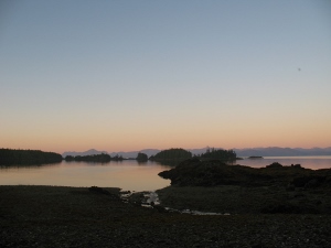
I think the log bridge crosses Driftwood Creek at Sunny Point – in the background it looks like the road descending from left to right.


It was just a few months later in January 1977 that Lynn took me into the basin, a ten-mile ski that started out gently but climbed steeply for the last stretch before we emerged into the basin itself. I hadn’t skied more than once or twice before we went. I borrowed long skinny skis and an oversize backpack from Steve and set out, convinced I could do anything. I don’t remember much about the trip in except feeling pretty good about things by the time we reached Sunny Point, the easy first half. Suffice it to say that we finally got to the foreman’s cabin a couple of hours later than Lynn anticipated. I was exhausted.


lynn-on-the-trail-338x600


The trail we followed up Driftwood Creek was one of three main prospecting routes into the Babines, as far back as the late 1800s. By 1905 several claims had been staked in the Driftwood drainage, including those of C.G. ‘Peavine’ Harvey after whom Harvey Mountain is named. In 1914 Peavine, his wife Kathleen20170204_114616_hdr_resized and infant son Gordon moved to their homestead on Driftwood Creek just up the road from our house. One of our snowshoe trails follows that old road, still visible as it leaves the hay fields and descends down to the creek near the old Harvey homestead.

20170204_114351_hdr2_resized

One of Gordon’s rakes, abandoned on our neighbour’s property in what was Gordon’s hay field.


While the Driftwood route into Silver King is a popular skiing and hiking trail into what is now the Babine Mountains Provincial Park, it was probably even busier in the 1920s. As Joe L’Orsa wrote in his unpublished history of the Babines, “In the words of Axel Elmsted, who was one of them, ‘The hills swarmed with old fossils.’ The Oldtimers, short on both modern-day geological techniques and clairvoyance but long on energy and elbow grease, dug innumerable trenches, tunnels, shafts, and pits, often on a little quartz stringer or bit of copper stain.”

The Lyon Creek Trail was once called the Gale & Lifton Trail and is thought to follow an old Wet’suwet’en route to hunt marmots in Ganowka Basin. A new trail was built to the Harvey mineral claim from the wagon road up Driftwood Creek, now known to hikers as Harvey Mountain Road.The McCabe Trail was built from the wagon road below Sunny Point along the back side of Harvey Mountain by Red McCabe on a trail grant under the provisions of the Mines Development Act.

The claims in Silver King Basin were among the earliest staked. According to L’Orsa,  a working adit was driven in at 4960’ in for 252’ where it “hit promising mineralization.” From the basin, the wagon road followed what is now a footpath zigzagging up the northeast wall over Hyland Pass to the Cronin mine. Exploration activity continued in the basin into the 1980s, hence the foreman’s cabin.

foremans-cabin-600x597

This is what the foreman’s cabin looked like in the summer of 1980. Sam?, Sheila and Daniel on his first trip to the basin.

By 1977, the foreman’s cabin was the most weather-resistant shelter left; there was an old cookhouse and a bunkhouse – the cookhouse by this time was full of packrat stink and porcupine quills and the bunkhouse was so big and drafty it was impossible to heat in winter. It was cold that night and my new sleeping bag wasn’t all it was cracked up to be.

In the morning, we explored the basin on skis – how nice was that without an oversize pack? – and then headed back down the trail. Anyone who has skied the trail knows about all the little divots along the way – seepages that melt the snow and form dips in the trail that are exciting for some, but were disastrous for me. I spent quite a bit of time either face down in the snow with the pack shoving me deeper in or face up like a beetle on its back, legs scrambling for purchase. The snow was deep. It was hard to get up. By the time we reached Sunny Point and the gentler sections, I was ready for a gentle cruise back to the car. No such luck. The trapper’s snowmobile had turned the track into an icy moguled death run for the unskilled. I seem to recall finally removing my skis and walking.

What’s truly a surprise after that inauspicious introduction to back country skiing is that I eventually married the fellow who took me in there. He was such a natural athlete he never thought to show me any technique to slow down or make even the gentlest turns. The only way I really knew how to stop on skates was to run into the boards; the only sure way I could stop on skis was to fall. And perhaps that’s why, now, my preferred winter footwear are snowshoes.

panorama-2-600x124

Silver King Basin holds the headwaters, the beginnings, of Driftwood Creek. It also feels like the place where my life in this part of the world began. Where the stream that carried me from the coast east to Ontario and finally to the northwest set a new course, creating for me a confluence with Driftwood Creek, with Watsonquah (the Bulkley), with the Skeena.  With home. So maybe it isn’t such a surprise I married Lynn. He was the first to take me into the mountains, into those mountains. I’ve never lost that feeling, felt for the first time on that trip into Silver King. A love for high places, for their loneliness and often desolation. For the way they remind you just how precarious and precious our tenure is. Here’s what I wrote the evening I got home:

sheila-in-cabin

Sheila in the foreman’s cabin, July 1977

It was worth it, as are most efforts which result in a high clear place where the wind blows from the top of the world and carries nothing but the air with it. It is eerie and lonely, almost frightening as I remember it from this warm house with the radio chirping away and my impatiens plant blooming. Skiing down into a vast white bowl, over marshes, creeks, boulders and a million varieties of mosses. Sinking not at all into the smooth white crust which covers the entire basin. The cabin was cozy with orange firelight flickering over golden walls of unfinished wood. But I couldn’t sleep – a funny scary feeling about all the things that could go wrong.

We have been back to Silver King Basin many times, though the foreman’s cabin is long gone. Over the years hundreds of visitors inscribed their names on the walls of the old buildings and wrote notes in the log book each new place holds. An elegant log building now provides luxurious shelter for folks who make their way in there, as they do in all seasons. And the basin is even more beautiful now as more and more of the old mining debris has been removed.

silverking-from-dc-headwaters-1977

The headwaters of Driftwood Creek above the mining buildings in 1977.

lynn-in-silverking-1977

Lynn looking across toward Mount Hyland from Silver King Lake.

sheila-at-silverking-lake

Sheila at the outlet of Silver King Lake, July 1977.

Unknown's avatar

Outflow winds

feather-600x517


When the pressure falls
bringing in the clouds,
the air softens. Ten above.
If you hunker down and listen
you can hear the crystals shift.
The snow slumps in on itself
and the creek, well, the creek
perks right up and so do the chickadees.

When the pressure rises
to clear the sky for the night’s big show
the temperature slips to fifteen below.
The snow gleams like beaten egg whites
and cold air stirs the hair against your cheek.
Pretty soon it’s slipping down the creek
toward the river,
the air that is,
and just as the river collects its creeks
at every confluence
those outflow winds
haul each other along
and pour toward the estuary
whipping up the waves against the tide at Tyee
white caps all the way across Flora Banks
out into Chatham Sound
until the Green Island light
is rimed with frozen spray.

In Hecate Strait
crab pots slide across treacherous decks
men and women holding on as best they can
below the glittering conjunction of the moon, Venus
and Mars.


Unknown's avatar

A Five Dipper Day

dipper-1-600x400

I might as well name the American dipper (Cinclus americana) my spirit animal. I frequent streams, especially the “clear, rushing, boulder-strewn mountain streams, within tall conifer forests. [I]float buoyantly and swim on the surface (poorly) by paddling with unwebbed toes. [I] frequently walk about on the gravelly bottom of streams.”

Chunky, fairly nondescript, not very musical except for moments in the spring when it even surprises itself.

The dipper is our only aquatic songbird. It feeds on the little creatures that live in the water – caddis flies, mayflies, mosquitoes (whoopee!) and also dragonflies, worms, fish eggs and even small fish. In winter, it’s hard to believe there’s anything in that water, but if you can find  a pebble to flip, you’ll see little shrimp-like wigglers squirming for cover.

I’ve only seen two nests – one in winter when we snowshoed down the creek all the way to the Bulkley; the other, the parents actively attending to the chicks inside, was behind a noisy waterfall in the Rockies. The nests are always near, and usually overhanging, a mountain stream, but they are easy to miss because they look like a clump of moss. Under bridges is another good spot to look.

Males and females may work together to build the ball-like nest, often in freezing temperatures. Materials are dipped into water before being woven into two layers: one, an outer shell, 8-10 inches in diameter, made of moss, and the other an inner chamber with a woven cup, 2-3 inches in diameter, made of grass, leaves, and bark. Once the nest is finished, the mossy shell absorbs moisture and the coarse grass keeps the inside dry.

Every birding book and website says they are mainly solitary, that after a pair brings its chicks to fledge, the parents usually divide the brood and head off to separate territories. But this fall and winter, we’ve seen two and very occasionally three foraging within a few feet of each other. We find one almost every day.

dipper-2-600x468

Sunday was special. A grey and gloomy morning, the road an inch-thick crust of ice. At the first dipper viewpoint, I spotted one in a newly opened pool just above a big log jam. We watched each other for a while and then I looked up the creek to where our snowshoe track had collapsed into another pool. Another dipper. And then, further up again, a third one.

Another km up the road, at an opening where we always look but rarely see them, there was another. And on the way home, looking downstream from the bridge that crosses the creek just below a tiny stream flowing out of a trickle of little springs, springs that never freeze, a fifth.

The dipper. Industrious. Likes the outdoors. Tends to stay resident all year round. Enjoys poking around under rocks in creekbeds. Spirit bird indeed. Almost forty years of turning over stones, tossing them in and skipping them across Driftwood Creek. Listening for the bird’s sharp alarm call.

Last fall, my grandson and I were both hunkered down beside the creek lynn-and-casey-at-creek-2-399x600when I started telling him about dippers. Just as I had told his father and uncle more than thirty years earlier. How they dive under the water and walk around on the bottom, how they blend right in with the stones they stand on, how they squawk as they fly up the curve of the creek.

One popped out of a nearby pool and looked us over, tilting its head, one eye zeroing in. The white eyelid. It hopped closer and closer. I held onto my grandson’s arm, stopping the pebble he was about to throw. We all watched each other for several seconds, me doing the little bobbing dance we always do when we see one: dip, dip, dip, dip, dipper!

The boy’s shout of laughter made that moment even better than a five dipper day.

(Thanks to Uncle Dan for the dipper photographs)

After reading this post, Mark Tworow sent this lovely reminder of summer and the creek in a completely different form.

Hi Sheila

I’ve attached Driftwood Creek in the Summer, one of the largest paintings I’ve ever done. (48 x 72)

driftwood-creek-in-the-summer-800x533

If you walk from the summer parking lot towards Sunny Point there’s a a small climb down a rocky slope to this pristine view of Driftwood Creek. The painting at such a large scale hoped to capture a small part of the feeling one has of this beautiful crystal clear creek tumbling around the water smoothed boulders. How many years has the creek flowed through here? The smooth boulders give a small answer, though the course of the creek has probably changed through the years. If you pass this place one summer, stop and pause here. It is a full place.

I think you might likely spot a dipper here too.

Mark

Sheila,

You can tell Mark that dippers live, fly and dive all along the Driftwood cinclezenrock_francoidepeycorridor…and yes indeed right downstream from the location of his painting by a place some locals refer to as Zen Rock.  I was lucky enough to catch one of them with my camera a couple of winters ago.

Cheers,

Françoi (Del Pais)

Unknown's avatar

The Mystery of Water

A soft mist of rain falling on even softer snow. The road a sheet of ice.  A pair of resident ravens squawk from the spruce trees down in the gully.

The January thaw, Joe L’Orsa patiently explained during my first winter here.

Great plops of snow slip off the roof, off the drooping alders. You can hear the crystals shifting.

Right now the creek is mostly silence. Snowshoeing just a couple of days ago, before this thaw, its voice is hard to track. At times the path is as quiet as any terrestrial winter trail when the snow is powder. At times the creek gurgles on our left from under that big old spruce curving way out beyond the bank. Then on our right, where the creek turns against its own current. At times a pool opens and we watch water moving over a sudden clarity of stones. Even when we’re breathing air that measures minus twenty. No wonder the dipper dives in.

dipper-on-ice-2-600x400

Dan Shervill photo

The mystery of water. How can it run at all when it’s been well below freezing for several weeks now? How can this side hill ooze moisture even after the frost has burrowed in deep? And why has our snowshoe path from a couple of days earlier disappeared into a new opening?

You think it’s going to happen again when the solid thunk thunk thunk of your snowshoes and the trail’s responding crunch shift into the hollow sound echoing from an air pocket under the ice. You hold your breath and hope the ice holds. You wonder, how big is the air pocket? If the ice suddenly opens, you hope the drop won’t be too far. But you know it’s there. And no matter how hard you try, you’re never ready for it.

The January thaw. The strangeness of rain falling on the snow still covering the ice under which the creek flows. The mystery of water.

Unknown's avatar

Forty Years: A Celebration of Driftwood Creek

creek-freezing-400x225

January 1977 – I moved to Smithers to work as a reporter at The Interior News, a paper with a venerable history and a crack reporter on staff. I was a new graduate and needed a mentor. A month later, he quit and I was the senior reporter. Now that was fun. Five months later I moved into a ratty little cabin the crack reporter (now working at the local bookstore) had purchased. A year later, I married him. And we’re still here, deep in the heart of Driftwood Canyon.

Our home is in Laksilyu territory of the Wet’suwet’en people in the House of Tsee K’al K’e yex (House on the Top of Flat Rock); the chief is Wah tah K’eght (Henry Alfred). Across the creek is Woos’s territory.

creek-2-225x400


This morning we strapped on our snowshoes and travelled a few kms down the creek. Minus 16 and the sun was shining up high on the canyon rim. The alders have grown about as big as they get around here – thirty years since the big Father’s Day flood scoured the creek clear of the small stuff and a few huge cottonwoods besides. But a route that we’ve skied and snowshoed many times is wide open. The log jams we used to clamber over are gone, the tricky rapids solidly frozen. It hasn’t been this cold for this long for years. It’s wonderful.


When I started thinking about a new writing project a few weeks back, stalled as I am on a series of poems, on a stubborn short story, on an unpublished novel, I was in the middle of reading Dart by Alice Oswald. A book-length poem Oswald compiled/created over three years, it traces the Dart River from its origins in Dartmoor in southwest England about twenty miles to its estuary at Totness and on for another nine miles to the English Channel at, of course, Dartmouth. She collected stories and narrates the poem in the voices of those who have lived, worked and played along its length.

Near the beginning, she speaks in the voice of an upland hiker:

What I love is one foot in front of another. South-south-west and down the contours. I go slipping between Black Ridge and White Horse Hill into a bowl of the moor where echoes can’t get out

listen,
a
lark
spinning
around
one
note
splitting
and
mending
it

and I find you in the reeds, a trickle coming out of a bank, a foal of a river

one step-width water
of linked stones
trills in the stones

What’s not to love about that?

We’ve all spent a fair bit of time thinking about the Sacred Headwaters over the past years. The Skeena, the Nass and the Stikine all rising out of a series of wide wet meadows high up in Spatsizi country. Many of us watched on film as Ali Howard searched for the Skeena’s beginning to start her epic swim to tidewater. Coalbed methane at the top end, fish farms proposed for the bottom end and the damn Northern Gateway project proposed to run right across the watershed’s eastern reaches. All done, all sorted. (I’m not going to start about Lelu Island here – the proverbial elephant in the room.)

snowshoe-hare-400x225Instead, I’m going to hunker down beside Driftwood Creek as I have so many times over the forty years I’ve lived here. In the early days, I read Annie Dillard’s Pilgrim at Tinker Creek. I loved the intensity with which she examined that creek flowing out of Virginia’s Blue Ridge Mountains. But I’ve got to tell you, the aquatic life is a little harder to find in a mountain stream that drops from an altitude of about 5000 feet in the Babine Mountains to its confluence with the Bulkley River at about 1200 feet in under thirty km. It never gets much warmer than ten degrees and I speak from experience.

small-creek-225x400Thank god for the dipper, which I thought was a tall tale when a couple of friends told me about it for the first time. A little grey bird that dives into the water and walks around looking for food, even when it’s forty below and there are only one or two openings in the whole damn creek. No way, I said. The water ouzel. I saw one a couple of days ago singing like it was spring.


So many stories. It’s too late to say, “Don’t get me started.” Instead, I’ll raise a glass of creekwater to celebrate its stubborn beauty.

PS. I’d be glad to hear your stories too – I’ll happily post them here.

Unknown's avatar

The layers of Lax Kwaxl

dundas island (300x225)A couple of weeks ago, I received a letter from Richard Overstall, a Smithers lawyer who brings to his work a deep knowledge of the layers that contribute to the rich upwelling of culture we call the north coast. His comments on The Bathymetry of Lax Kwaxl certainly enriched my admittedly shallow understanding of the Melville Dundas area. I thank him for that.

Richard is currently involved with the LNG assessment at Lelu Island.

September 23, 2016

Dear Sheila:

I very much appreciated your chapbook, The Bathymetry of Lax Kwaxl. It so gently and firmly sets one on the shores of this archipelago of North Coast islands. It also immediately caught my eye as I have been reading and note-taking about Lax Kwaxł for some time as it is a key location in the development of the northern North Coast indigenous legal order.

As a historical centre of northern coastal peoples, Lax Kwaxł at one time may have rivalled the cluster of villages in Metlakatla Pass. Carbon dating from archaeological work currently has the oldest Lax Kwaxł villages appearing before 5000 BC, about a millennium earlier than the oldest found around Metlakatla and Prince Rupert Harbour.[1]

In the region, only the small settlement on Lucy Island, Laxspano, has, so far, found to have been older at around 5600 BC. Interestingly, the oldest human remains found on Lucy Island (4100 BC) have the same rare mtDNA haplogroup (inherited through mothers) as the even older (8000 BC) human remains from On Your Knees Cave in northern Prince of Wales Island in south east Alaska. No living North Coast people have been found with this rare mtDNA haplogroup. One could speculate that these peoples were members of the Wudisaneidi (Old-age beings) who, Tlingit elders told Lt. Emmons, came from off shore and settled on Dall Island, west of Prince of Wales Island, later to be joined by interior groups to form the Tlingit Wolf Teikweidi Clan.

You mention a memory of salmon smoking. This activity may not have occurred on Lax Kwaxł. Before about 1000 BC, the salmon bone density in the surveyed archaeological sites is very low, close to zero in many cases. The faunal remains and the small size of the villages at that time suggest to the archaeologists that the people were year-round marine hunters and gatherers. This view is supported by oral histories. When famines from this time are mentioned, they were not caused by lack of food resources but by series of winter storms that prevented people from travelling by canoe to their resource sites. In later times, while the proportion of salmon bones in the Lax Kwaxł middens increases, the oral histories give evidence that the people living on the Dundas Island group had salmon fishing sites in the Prince Rupert Harbour area – Tuck Inlet, Work Channel, Khutzamateen River and Kwinamass River. These areas are a more likely source of the salmon and where the fish were likely smoke-dried before being transported to Lax Kwaxł. As you know, the Dundas group has very few salmon streams – certainly not enough to support the number of large villages that for a long time existed there.

Oral histories from Kitkatla record that the ancestors of certain Tlingit Ravens were living on Dundas Island before the mythic flood. Tlingit people call the Dundas archipelago Waklt and called the Raven group that lived there, the Wakldeidi. Whether this name is a loan word from the Tsimshian waxł, meaning beaver tail, or vice versa is not clear to me. The Tsimshian Lax|k|waxł literally translates as on|place of|beaver tail, although the word waxł does not incorporate as elements the Tsimshian word for beaver, sts’ool, or the Tsimshian word for tail, ts’uup.

Tlingit oral histories record a group of Raven people migrating south along the western shore of Prince of Wales Island to its southern tip. Here they met another group of Ravens, the ‘old settler Houses’ who had “lived there a long time.” Some of the old settlers moved on to Duke Island and eventually to the Dundas archipelago where they met the Wakldeidi. Meanwhile, in Metlakatla Pass and Prince Rupert Harbour, Tsimshian histories refer to a time “when only Wolves lived at Metlakatla.” One Wolf Clan group led by Asagalyeen was eventually “chased out to sea” by Raven people led by Ayagansk. Other Wolves remained, as up until about two millennia ago, Wolf Clan and Raven Clan peoples living at Lax Kwaxł, the Harbour and adjacent areas appear to have spoken a predecessor of the Tlingit language. While each clan group was exogamous and intermarried with the other, their relationship was fractious and unstable. Both Lax Kwaxł and Metlakatla were comprised of year-round villages, aggregated probably for defensive purposes. From these bases, people set out in the spring and summer to various camps to get eulachon, salmon, sea mammals, and other foodstuffs, which they stored in their village houses for over-winter use.

Between 200 and 600 AD, however, all the permanent settlements on the Dundas archipelago were suddenly and completely abandoned.  At the same time, there was a hiatus in the occupation of many Metlakatla and harbour sites with archaeological artifacts and human remains showing evidence of warfare. The impetus for this increased conflict appears to have been a movement of people from the lower Skeena River into the Prince Rupert Harbour area. They were very soon joined by migrants from Temlaxham, who originally lived around the confluence of the Bulkley and Skeena rivers. These newcomers to the coast eventually joined with others to become the Gispwudwada Clan – the Killerwhale/Fireweeds. They may well have introduced what is now the Tsimshian language to the coast, as well as the concept of “royal” Houses, which exclusively provide the Chiefs for each Tsimshian tribe. Later migrants, including some originally from the area at the confluence of the Stikine and Tahltan rivers, formed a fourth Tsimshian clan, the Lax Skiik (Eagles), who also contributed royal Houses.

The permanent winter village complex in Metlakatla Pass and Prince Rupert Harbour subsequently flourished, while that at Lax Kwaxł never did recover. In the 1500 years until now, Lax Kwaxł has been used only for seasonal marine harvest activities. For example, Green Island that you mention, Laxki’I, has been a camp used as a base to harvest seals, halibut and gulls’ eggs. Until very recent post-contact times, these camps had been used by both Tlingit and Tsimshian families.

Richard

[1] The earliest Prince Rupert harbour archaeological site, at around 4250 BC, is in Dodge Cove, itself the setting and subject of another chap book, Seahorse by Patrick Williston and Mark Tworow.

Unknown's avatar

Lelu Island Lace

shawl-1

I’m just coming to the end of a lace project called Estuary, by designer Emily Wessel. I was first drawn to knit this shawl by its name. Emily describes her inspiration for this design: An estuary is an in-between place, not ocean, yet no longer river. It is a fertile habitat where sweet and salt water mix, and many species thrive. Estuary combines two lace patterns to create an ambiguous shape: not quite a shawl, yet something more than a scarf.

There are more beautiful – extravagant, filigreed, starbursts, leafy, vine trellised – lace patterns. But I’ve been knitting this shawl to honour the Skeena estuary. In it, I see the Flora Banks emerging as the tide retreats, the salmon finding their way back up the river after their time at sea, all the young smolts collecting in adolescent jitteriness after their first river descent. Both coming and going they feed the eagles, the sea lions, the gulls, the seals. And us too. So many of us fed for thousands of years.

more-smelts-at-lelu

Photo courtesy Tavish Campbell

The shawl has been a difficult project for me, partly because I’ve picked it up and put it down many times over the past year, but also because the pattern is complex. By combining two different patterns, it mimics the sweet water meeting the salt and you need to pay very careful attention as it grows.

Lace is often like this. Lose concentration and you can find yourself and your stitches in a muddle. And the thing about knitting lace is it’s almost impossible to correct mistakes. The structure, with all its intentional gaps, the pulling together and drawing apart of threads, means you can’t just unravel it and pick it up again like you can with a plain sock or sweater. The structure you’ve laboured so long to create disappears.

skeena-estuary

Photo courtesy Tavish Campbell

Which brings me to the Skeena estuary. It is re-drawn daily by the tides, weekly by the weather and seasonally by the collection and release of the rain and snow that has fallen throughout the watershed. It has a long history, a place more layered and complex than any lace. You can’t break the pattern and expect to be able to fix it later.


overview-of-lng-plant

If you plunk an LNG port* on Lelu Island, stretch a bridge across Flora Banks and the eelgrass where salmon smolt gather to the tanker dock at the edge of Chatham Sound, drill, blast, dredge and set up a huge humming structure complete with gas flares and tankers, well you’ve unravelled something that’s taken thousands of years to emerge from the debris of our last ice age.

How ironic to even consider building this example of Anthropocene hubris in this spot. If you add the expansion to the fracking chaos of northeastern BC this project will necessitate to its enormous greenhouse gas emissions, you’ll be speeding up the final melting of ice that began the process, thousands of years ago to create the Skeena estuary. The melting could well see the whole LNG structure itself lost beneath tidal surges within decades.

Maybe we should send Justin Trudeau, Catherine McKenna and Christy Clark each a fragment of unravelling lace and see how well they can pick up the stitches to re-establish the pattern. All while treading water.

* If you want to know more about Petronas’s LNG project, a project approved by the Canadian government just days before it ratified the Paris agreement on climate change, check out Skeena Watershed Conservation Coalition’s video.

Thanks to Graeme Pole for the images from No More Pipelines.

Unknown's avatar

Go outside. Get high.

silverking-basin-500x274

We went for a hike on Thursday. The garden is mostly done except for a few lettuce plants and a small plot ready for the garlic. Oh yeah. Pull up the fading sweet peas, say adios to the glorious clematis and kiss the one volunteer sunflower goodbye. Not yet, I tell them, not today. Summer comes to an end soon enough in Driftwood Canyon. Today I’m going into the mountains.

Which means I can ignore the itch that drives me upstairs this time of year. The itch and that damn caterwauling on the landing, the cat telling me to get my arse up there and into the chair. Or she’ll find something precious to knock off my desk.

I’m in that miserable stage of a writing project where a dozen ideas are roiling around inside what passes for my mind, and I’m scared to begin because once I do, well, all sorts of possibilities are lost. So hiking is a great distraction. It’s perfect this time of year. No mosquitoes. Not too hot. The flowers are mostly gone, but the colours of fireweed, huckleberries, willow and those red-leaved blueberries light up the alpine meadows.

the-trail-281x500The trail we pick is a gentle one – it follows the northern contour of Harvey Mountain with lots of views across Driftwood Creek to the mountains on the other side. No snow yet, and great swathes of red and yellow. An iron streak right through the mountain range. The roar of the creek fades as we climb high above its passage. A varied thrush lifts off the trail into a sub-alpine fir, letting us get a clear look. We hear them ringing all spring and summer, but rarely see them as anything but shadows.  A male spruce grouse, its red eyebrows still visible. Across the way, two mountain goats and then two more.

across-the-creek-281x500


When you’re walking, though – climbing, sweating and puffing – it’s not all wonder and delight. Hips hurt, feet stumble, and you find yourself thinking about writing after all. The doubts that ring louder as you get older: the growing pointlessness as you see what a broken place the world is, what broken creatures we are. The millions of words thrown out to see what they might hook.

You never know when writing might bring you to a sense of intense connection and understanding – the words feeling like wisdom from a far off spectral being – but often you wonder just what the hell you’re doing as those words shiver and dissolve. Forgotten.

So too the trail. You find moments of pure joy when everything clicks and your feet feel a passage created by thousands of footsteps following the same path, some of them your own. How it takes you across a precipitous traverse and deposits you in wildness. In beauty, the blueberries sweet in your mouth. The trail opens you up, even if sometimes it’s rough, sometimes wet, cold, and sometimes frightening: the huge bear scat purpled by the same kind of berries you’ve just eaten. The fear that makes wildness what it is. The fear that gives any good writing the edge it needs, the fear that underlies everything we do. Knowing it will all get along just fine when we’re gone.

But, oh god, that feeling.

aline-meadow-500x281

That fist in the air hurrah when the trail emerges into the glorious alpine meadows we get around here. The feeling when the writing falls into place, all the dead-ended game trails, all the boot-soaking bogs, the bruised shins and blistered feet forgotten. That feeling when it not only makes sense but makes the new kind of sense you want to study a bit farther. Use as a prism to refract what you think you know into something different, something bigger.

It’s always worth it.


Unknown's avatar

Kayaking in the snow

I must confess that I dedicate no inconsiderable portion of my time to other people’s thoughts. I dream away my life in others’ speculations. I love to lose myself in other men’s minds. When I am not walking, I am reading, I cannot sit and think. Books think for me.
From “Detached Thoughts on Books and Reading” by Charles Lamb, 1822

So there we were at the far end of Maligne Lake south of Jasper just last week.

We left on a Monday morning from the boat ramp at the end of the long road from Jasper, the calm water reflecting the stunning mountains that surround the lake. One of the classic images on postcards advertising the beauties of the park. Turquoise water, a tonsure of conifers and the grey stone twisting its way into the sky. Barely any snow.

Maligne day one (600x450)

As we sorted and dithered and stuffed our food, tent, sleeping bags, thermarests, tarps, clothes, camera, books, water bottles, cooking gear and toilet paper into the resistant nooks and crannies only a kayak hatch can create, we worried. The forecast was not good – some sun, yes, but rain, too. And it was cool. About 10 degrees.

Finally loaded, booted, spray-skirted, life-jacketed, a big cooking pot at my feet, a bag of wine between my legs, we departed. There’s a funny weightlessness to kayaking (until you try to haul yourself up and out). You are tucked into a boat loaded with all the stuff you feel you need to survive and you’re floating. The boat becomes your lower body, your arms as long as the paddles. It’s a lovely feeling once you’re underway.

The 24-km trip down to Coronet Creek was long, but uneventful. No rain, little wind and a couple of easy landings for rests and food. The water was so calm, we were able to cut across some of the bays to shorten the paddle. What could be better? Our kayaks floated, our bodies more or less worked, and the weatheLeaving Coronet (600x450)r cooperated. An osprey, a noisy family of Clark’s nutcrackers and those mountains. Here in the Bulkley Valley, the mountains are mostly gentle, rounded by glaciation. A few sharper peaks rise dramatically to heights that weren’t covered by the great ice sheet that filled the valley anywhere from twenty to forty thousand years ago. But those Rockies! Paddling through the jagged explosion of stone, it’s easy to visualize the Pacific Terrane inexorably moving into what is now Alberta, pushing and pushing until the rock shuddered, twisted and shattered, throwing those impossible peaks into the air. About 85 million years ago. Everything is insignificant in the shadow of those mountains.

Of course, it’s still happening – the movement that is. Our continents are really stone plates riding on top of earth’s molten core. Deep in Jules Verne territory. You can believe almost anything geological as you paddle down Maligne Lake, every few kilometres revealing a new view, our heads turning to trace new contours.


Maligne Day One through the narrows (600x429)

Coronet Creek itself creates an alluvial fan treed with scrubby conifers, Labrador tea, willow and juniper. We pull ashore, haul ourselves out and begin to set up camp. We’re good at this, each of us doing a series of tasks in sync with the others. The campsite is basic – some tent platforms, an outhouse, a few picnic tables and food lockers (we’re actually more accustomed to wilderness camping, but this is a national park). By the time it starts to rain, we’re all done and gather with the other campers under our tarps: Ontario honeymooners on their third canoe trip here; a grandfather, son and grandson whose family have been fishing the lake for decades; and two mountain guides from Jasper on a busman’s holiday.

Coronet Creek (600x450)We trade stories under the din of rain on tarps, drink a little wine, eat our various dinners and go to bed early, hunkering into the pockets of heat and cold a down sleeping bag creates. We don’t need our head lamps to read because we’re only a week away from the solstice.

It was with some uncertainty I embarked upon the book I’d brought along – Ian Brown’s The Boy in the Moon, a memoir about life with his severely disabled son: Walker Henry Schneller Brown. I was immediately transplanted into a world whose difficulties made my unease in a tent on the cold shores of Maligne Lake shrink into insignificance. Afflicted with the very rare cardiofaciocutaneous syndrome (CFC), Walker is unable to communicate, is fed through a stomach tube and, as he gets older, begins to beat himself so badly he needs to wear a helmet and tubes on his arms that don’t allow him to bend his elbows. Within a few paragraphs, we enter the long dark tunnel of loving this boy.

Brown leaves no emotion – guilt, anger, resentment, joy, awe – unexamined. He explores the ways we deal with such children, the ways they have been cared for, neglected or abused over the centuries, the unlocking of the human genome and what it might mean if all “defective” fetuses can be aborted, theories about how the interrelationship between the brain and the external world produce the mind, strategies to provide for children post parental death. He pins down every sugary sentiment and excoriates it. While he finds that being in the presence of and caring for people with such disabilities does teach us a lot about ourselves, he rejects the idea that these children are somehow “sent” to teach us. Rather, he argues, they are truly human, like all of us. They are on their way to becoming who they are and, like all of us, are vulnerable creatures faced with death. This is why they scare so many of us. They remind us, he says, of our own vulnerability and mortality:

I do not see the face of the Almighty in Walker. Instead, I see the face of my boy; I see what is human, and lovely and flawed at once. Walker is no saint and neither am I. I can’t bear to watch him bash himself every day, but I can try to understand why he does it. The more I struggle to face my limitations as a father, the less I want to trade him. Not just because we have a physical bond, a big simple thing; not just because he’s taught me the difference between a real problem and a mere complaint; not just because he makes me more serious, makes me appreciate time and Hayley and my wife and friends, and all the sweetness that one day ebbs away. I have begun simply to love him as he is, because I’ve discovered I can; because we can be who we are, weary dad and broken boy, without alteration or apology, in the here and now. The relief that comes with such a relationship still surprises me. There is no planning with this boy. I go where he goes.

The questions people with severe disabilities are always asking, he surmises are: Do you consider me human? Can I trust you? Do you love me? The technology most desired are electric wheelchairs, he discovers. Not for the mobility they offer, but because they enable their users to go toward the people they love and stay away from the people they don’t like.

I thought about Brown’s family all the next day as we hiked up to the waterfalls on Coronet Creek, as I baked cinnamon buns over the spirit stove, cooked spinach fettuccine for dinner. The temperature never rose much above 12 degrees and on the few occasions our shadows appeared we stopped and rolled our tired shoulders in delight.

The book finishes with a scene in one of many hospital visits. Brown is waiting with Walker for an MRI appointment when the boy has a seizure.

I held him in my arms as quietly as I could, and I thought: this is what it will be like if he dies. It will be like this. There was nothing much to do. I didn’t fear it. I was already as close as I could be to him; there was no space between my son and me, no gap or air, no expectation or disappointment, no failure or success: only what he was, a swooned boy, my silent sometimes laughing companion, and my son. I knew I loved him, and I knew he knew it. I held that sweetness in my arms, and waited for whatever was going to happen next. We did that together.

Anyone who has an ill child has felt that sweetness, that exhausted ending of fear and the sinking into a place where waiting is all there is. Waiting and love.

The Boy in the Moon is an excruciating book, but as I lay in the tent on our last night at the far end of the lake and listened to snow rustle on the fly, wondering just how difficult the paddle back to the other end of Maligne Lake would be, wondering if we were going to be turned back like the young couple the day before when the waves broke over the gunwales of their canoe, I was strangely comforted by the book. I heard Brown’s voice as I tried to sleep. I heard him as we listened to the wind gusting down from those ragged mountains. As we set out into snow flurries to paddle back.

Leaving Fisherman's Camp (600x450)I thought about Walker as we braced against the headwind that hit us as we tried to paddle through the lake’s narrow waist. I dug in deep, remembering the insights Brown came to on his family’s difficult journey. And the work of paddling was lightened. We laughed when the wind finally turned and we unfurled our umbrellas to sail back to our usual comforts, our familiar thoughts, our ordinary lives. Our journey had been, for us, an adventure with just enough difficulty and uncertainty to give it an edge. But my journey with Ian Brown took me beyond the small difficulties into a wildness as earth-shattering as the mountains themselves.

Like Charles Lamb, I love to lose myself in the minds of others, especially when they contain the fierce and compassionate intellect of a man like Brown, who also happens to write beautifully.

Thank you, Ian Brown. And thank you, Walker.


Anne on Day Three (600x450)


Unknown's avatar

Revisiting Canyon Creek

For many years now, I’ve been invited to accompany students from Jonathan Boone’s First Nations Studies class at the Bulkley Valley Christian School on a tour  that includes the homesite referenced in Canyon Creek: A Script. We travel a path following the Telkwa-Morictown Highroad (the old Bulkley Valley Road and part of the Collins Overland Telegraph route), dipping down to Canyon Creek, then up Jollymore Road to Jack and Elizabeth Joseph’s old cabin. From there we can look across a big swamp, some aspen bush to the fields below what’s known locally as the Baptiste Reserve, the place where one Wet’suwet’en, John Baptiste, successfully prevented eviction from his homesite.

Along the way, I usually pull out the 1913 township map, Canyon Creek Mary’s Wet’suweten family tree, a typed transcript from the 1915 testimony given to the Royal Commission on Indian Affairs by John Baptiste, Tyee Lake David, Big Pierre, Tyee Lake Abraham, Round Lake Tommy, Moose Skin Johnny and Jimmy Thomas, son of Canyon Creek Mary and Thomas (Jack Joseph is listed as the translator) and my notes from interviews done while writing the book.

We read the book together, point out features on the landscape (the path of the old trail the Wet’suwet’en used to connect their properties, the site of the burned-out house, the old root-cellar) and talk. Over those years, Jonathan Boone has made a tremendous effort to inform his mostly non-native students about the history of the Wet’suwet’en upon whose territory our community is built.

This year I was especially pleased to accompany students from the Moricetown
I Count High School on this, what is for me, a pilgrimage.

Icount 1 (600x400)

As we stretched out the very long genealogy chart, some of the students recognized family names. Others remembered stories about Jack Joseph’s capture of the bank robber.

j joseph's cabine 2 (600x400)


We usually end our trip at the old Joseph house, still standing after, I suspect, more than one hundred years. Jack and Elizabeth had thirteen children altogether – let’s hope some of the kids had grown and moved out before the littlest ones came along!


cabin again (600x400)

Things are definitely changing along the old Bulkley Valley road, slow as those changes might seem. Thanks to the staff and students for asking me to accompany them for a few steps on their journey.