Driftwood Creek – its outlet


I know it’s time to begin to wind down these Driftwood Creek reflections now that we’ve moved. But images keep arising. This time of year we’d have been looking for harlequins, we’d have been wondering how wild the spring freshet would become. First thing in the morning, we’d hear its muted rumble through the open bedroom window. The creek filled our well and watered our garden. When I think of all the stones we tossed its way! All the rocks we winged at passing sticks – to hit them, to sink them, to unsnag them. Laughing, competing, losing, succeeding and still the sticks floated off, tumbling downstream to join the pile of driftwood at the mouth of the creek. Along the banks of the Skeena all the way to tide water. Cumshewa, the Chinook word for bleached driftwood – or the white men drifting into shore in their big boats and floating off again at high tide.

The creek is a path we seldom take – except in winter. As Eminem sings,

I walk on water
But I ain’t no Jesus
I walk on water
But only when it freezes

We skied from our house down to the confluence one winter, maybe 1979. We snowshoed down in the early 2000s with Jim and Rosamund Pojar. I remember a large wing print in blood-splattered snow, a dipper nest in the canyon by Nageli’s bridge, and a complicated descent over a rockfall. The descent was not as much fun for us as it had been for the otters, the smooth grooves of their slide trails twisting and turning through the boulders.

That rockfall just above the confluence, over forty years old now, stops the salmon that used to come miles up the creek. But the fish still come to the pools below, feeling the tug on their hearts, the ravelling up of an ancient genetic thread.

Once I started the Driftwood Creek project, I wanted to revisit the confluence and find that rockfall again. We even talked about initiating a salmonid enhancement project to clear the rockfall and allow salmon back up the creek.

The route down to the river.

We found a pleasant route through Walter Faeh’s property down to the Bulkley and downstream to the confluence. We repeated this trip many times over the last couple of years. We tried to follow the creek up to the rockfall, but kept getting blocked by seriously precipitous canyons, the conditions never quite right on foot or snowshoe to persevere.

One lunch at the confluence.


Another lunch with Karen and Owen Diemert.


When we finally had the sense to ask, Tristan and Damien Jones pointed us in the right direction. Last fall we slithered down the slope beside their house to the creek and followed it up to the rockfall. Any thoughts we had of clearing it evaporated. Indeed, it seemed miraculous that the creek had ever found a way through. How we snowshoed our way down the jumble of huge boulders that winter so many years ago baffles me – there must have been tons of snow.


These canyons, where the creek pushes back against the rocks that were once liquid themselves – rocks thrust up into their own future – are special places. They form passages through pools of light, openings in a geological shadow. Secret places away from our roads, our trails, our bridges. You’ll find them in many places along Driftwood Creek, from its beginnings to its end. Like the one just above Al Fletcher’s disintegrating cabin. The one below Nageli’s. And this one.

Hidden from most of us most of the time, but not from the dipper who knows the creek and its canyons summer and winter. And as if in response to my hopes, we found one right at the bottom of the rockfall that day last fall. The animal spirit of the creek, binding it all together.

Thanks to Karen, Bruce, Owen, Jim, Poppy, Joan, Brent, Pica and the others who accompanied us on the trips to the confluence. Some of these pictures are likely theirs.


Beginnings – the height of land

Don Parmeter’s aerial photograph of the Driftwood Creek headwaters.

The concept of watersheds has long fascinated me, as the many posts about Driftwood Creek illustrate. Back in 1977 when I worked for a Terrace newspaper, a regional district staffer, Doug Aberly, suggested provincial programs be managed in integrated watershed districts rather than in the piecemeal way jurisdictions were and still are divided. Long before that, Indigenous nations  divided territories along geographical lines of watersheds rather than the methods used in Canada’s Dominion Land Survey system which created townships and one-mile square sections of land, completely ignoring the natural boundaries provided by creeks, rivers, and mountains.

Years later, I opened a play, The Height of Land, with the image of a woman squatting to pee (women’s attention is more focused on the ground between our feet at these moments) and wondering which way her urine would run – if she was in just the right place (like the Columbia Icefields) could her urine eventually reach three oceans?  A shift of inches could produce an entirely different outcome – a little like that butterfly flapping its wings in Beijing.

Then I took a geography course from Rick Trowbridge at what was then Northwest Community College. He showed us a short film that began with the image of a single drop of water splatting onto the ground. Whether it was soaked up, frozen, evaporated, or ran into the nearest stream, it eventually returned to the sea via one watershed or another. While the term height of land sounds as if it should stand out – a hill or mountain – it is often the opposite.  Think the country north of Prince George along the nine-mile Giscome Portage where the watershed shifts from the Fraser to the Peace (via the Crooked and Parsnip rivers). Nothing dramatic there. And Rose Lake just west of Burns Lake, the division between the Fraser and Bulkley/Skeena river basins. Again, hardly a hill in sight.

Driftwood Creek’s beginnings are a little more dramatic where the watershed shifts from Driftwood Creek and the Bulkley to Cronin Creek and the Fulton and Babine rivers. A sensible boundary between Witsuwit’en and Nedut’en territory.

Lynn and I scrambled up above the cabins in Silverking Basin in 1977 on our first extended camping trip into the Babines. We fought the shintangle to reach the small lakes in the basin whose walls create one of the boundaries between those watersheds and also between Silverking and Grassy Mountain and the Twobridge (Reiseter) watershed.

Dan, the Rhebergen girls and Gisela Mendel.

Our eldest son, Daniel, went with me and Gisela Mendel in 1991/2 on a weekend trip into the basin. We joined Frank Rhebergen and his daughters to climb up the shintangle again into the headwaters. We made it up onto the flank of Cronin and crossed over to the Hyland Pass Trail – a route we tried to do in reverse the summer before last. We didn’t succeed, so Don Parmeter very kindly gave me the beautiful aerial photograph at the top of this post.


The kids with Silverking Basin and Harvey Mountain in the background.


Me and Dan below the glacier.


Lynn and Jim Pojar on Grassy Mountain, the Fulton side of the watershed divide.


All those watersheds draining into the Skeena Basin, into the Pacific Ocean.

And now we live right beside the same ocean. Here many creeks run straight to salt water without a river in sight. It’s a new kind of geography. For a river to get big, it needs to start far away from its final outlet. Once you think about it, it seems obvious, but coming originally from Powell River as I do, I didn’t really understand rivers. Powell River, the river that is, is one of the shortest in the world. Maybe that’s why I ended my novel, The Taste of Ashes, beside the Nautley River which drains Fraser Lake a mere 800 metres before it empties into the Nechako. Another “shortest” river. It felt something like home.


Hudson’s Bay Company Ranch

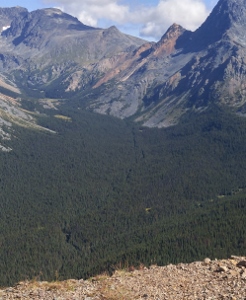
I had a wonderful walk in early September with Eileen Shorter who very kindly took me on the route where the Collins Overland telegraph trail and what later came to be known as the Bulkley Valley Road (now the Telkwa Highroad) crossed her property onto the Nageli farm. It was a beautiful fall day, the early fallen leaves marking the road, the old ditches a slight depression on either side. We walked to the edge of Driftwood Creek where we found some signs of an old bridge.


In an earlier blog, I wrote about the many ways  Driftwood Creek has been crossed; before the current bridge location (see pink dot) was used, the creek was crossed at the green dot, just where the Nageli farmhouse sits high above the road.

Here’s what Alan Pickard said:

A bridge across Driftwood Creek is shown on J H Gray’s correctional survey field notes for 27 December 1906. This bridge is on Lot 844 on what was then the Hudson’s Bay Company ranch.  A 2 km road had been constructed on the true left of the creek from the Telegraph Trail crossing of Driftwood Creek to a place where a short log bridge could be put across using rocky banks on both sides. British Columbia Archives photo A-05288 dated 1905 is most likely the bridge across Driftwood Creek on Lot 844. Although there is a private farm bridge [the Nageli’s] at this location now, it was decided by the Highways Department that a bridge at the Lot 844 site would not be renewed in 1916. Therefore a bridge existed across Driftwood Creek on Lot 844 from 1905 to about 1916.

I don’t think that the remnants I saw match the bridge in the photo – it doesn’t look like the same crossing place. But it was definitely one of the bridges that crossed Driftwood Creek to connect the old pack trail from Aldemere to the Hudson’s Bay Ranch on its way to Witset and eventually Hazelton.


The bridge timbers indicate a crossing with one end on the downstream shoulder of the rock outcropping on the right and the other immediately below the Nageli farmhouse.

Alan Pickard again:

The Hudson’s Bay Ranch was Lot 844, Township 2A, Coast District. This was actually the NW 1/4 of Section 16, NE 1/4 of Section 17, SE 1/4 of Section 20, and SW 1/4 of Section 21, Township 2A, Range 5, Coast.

The HB Co. paid $1,600 for this land and were given the Crown Grant on 13 October 1902.

R S Sargent “staked” this land in 1898. This means he measured the land off the 1892 Poudrier survey posts and selected the best hay land he could. But he had to abide by the rules of the Land Office and “stake” 1/4 sections etc. But there was no ability for the Lands Office, presumably in Victoria at that time, to handle the request for land by the HB Co., so they were allowed to use the land without some government agent checking things out locally.

Of course Sargent chose land on the pack train trail, which was the 1866 Collins Overland Telegraph trail.

What Alan’s research doesn’t refer to is an earlier owner. A Witsuwit’en petition to the 1909 Stewart/Vowell Commission hearing in Hagwilget stated that a Witsuwit’en woman, Mrs. Leo, and her daughter Nellie (together with 10 cattle and horses) had been living at Lot 844 before this. Richard Overstall writes:

The records show that the main Bulkley Valley hay farms in the early twentieth century were originally developed and owned by [Witsuwit’en] families: the Hudson Bay Ranch on Lot 844 was known as Sesink’en and worked by Mrs. Leo and her daughter, Nellie; the Glentanna Ranch at Lot 861 was known as Dee’tsilyee and run by Peter Michel’s family…

I haven’t found out how or when the title shifted, but Stories of Swiss Settlement in the Bulkley Valley records that Herman Nageli bought the farm from Harry Zogoff in 1948. Herman and Anne’s second child, Esther, was born in 1962. “My dad had all kinds of stories about Harry, that maybe he had been involved in some way with the Hazelton bank robbery and if my dad looked in the right spot he might find something.”

She showed me the barn, which is the only one of the old Hudson’s Bay buildings still standing.

There was an old granary that had a beautiful wooden floor we liked to play in and this one snowy morning the roof was down … that’s where we had chickens and such, but my dad always called it the granary…there was a bunkhouse, there were barns when I was a child, and my dad knew some of the stories … a really old man arrived with his great grandson and he had worked there as a young child, maybe nine or ten years old, and he was doing a trip through the valley to remember his youth … I remember that we were enthralled that he had been there; he was this wrinkly little tiny old person.

On the left, the old farmhouse from across Driftwood Creek; on the right the logwork of the house is typical of many houses of the same era. The stonework in the basement dates from the original ranch.


So the location of the Driftwood watershed’s Hudson Bay Ranch is clearly established. But in the course of editing Creekstone Press’s latest book, Shared Histories, I found Witsuwit’en people refer to the Oschawwinna Reserve 3, a location much closer to Witset (Moricetown) as the Hudson Bay Ranch.

Wilat Sue Alfred told me the story of how her family had been moved from place to place as settlers took up land in the Bulkley Valley.

What happened is they were all south of Houston where my grandmother had territory – Sam Goosley Lake – they all lived there, my mother, my aunties, my uncles were all born out there on the territory – What they now call Buck Falls, Nilt tsi – means misty falls – they were all living out there and all of a sudden the government came in, they took them off the territory and they placed them in Glentanna and what grandpa’s family did, they cleared the land, huge land and they were going to build a log house, what did they do? they came again, and what they did, they put them in Oschawwinna.

Melanie Morin’s book, Niwhts’ide’nï Hibi’it’ën: The Ways of our Ancestors, cites Likhdïlye Russell Tiljoe’s memories of his father, Alec Tiljoe, wintering horses for the Hudson’s Bay Company there. When I spoke to Russell, he confirmed the story. His father and uncle, Antoine, ran pack trains for the Hudson’s Bay Company from Old Hazelton to Aldemere and Telkwa in the 1910s. His grandparents also lived there – it was in the Tsayu territory – Alec’s clan.

Out for a walk to Driftwood Creek’s confluence with the Bulkley River, I was trying to pinpoint the date we hiked up the old trail. I wanted pictures. It turns out, none of us had any, but a few minutes further along, right beside the creek, Jim Pojar spotted this hawthorn bush. Go figure!

In fact, the old Moricetown-Cronin trail passes through there, a trail that took people from Witset to Babine Lake along the back side of the Babines. And the name of the reserve, Oschawwinna, means prickly and refers to the black hawthorn bushes that grow in a clearing there – north of the Telkwa Highroad up toward Duckwing Lake. It’s the only place he knows of where it grows. (The plant, Cratageus douglasii, is more commonly found in the Skeena drainage). We walked through there years ago, trying to retrace the trail, and were entranced by the open meadow with the big prickly bushes in the middle. Alan Pickard writes:

In the summer of 1898 the HB Co. also allowed their pack train to graze and they cut hay on land claimed by the Witsuwit’en. This was the 160 acres that was or became Oschawwinna 3 reserve. This reserve was laid out by O’Reilly on 19 September 1891, and finally surveyed by E M Skinner in 1899. R E Loring was also involved with the layout of this reserve.

An August 31, 1898 article in the Victoria Daily Colonist states that the Hudson’s Bay Company

had cut some hay at a place beyond Moricetown, claimed by the Indians as a reservation, and the latter protested. The affair was at once brought to the attention of the department, with the result that it has been amicably settled, the natives being found right in their contentions, and the Hudson’s Bay company being ready to recompense them for the hay taken.

Since the place was already established as a reserve, the claims were heeded. However, claims for other Witsuwit’en homesites along the pack train route were not heeded. I’ve written about the people at Canyon Creek in my first book, Canyon Creek: A Script. In it, there’s a reference to Peter Michel, Wilat Sue Alfred’s grandfather. He made a claim to his homesite at Glentanna to the 1915 McKenna/McBride Commission:

  1.  Now we come to the application of Peter Michel.
    PETER MICHEL IS CALLED AND SWORN:
    MR. COMMISSIONER MACDOWALL:
    Q.    You had a house which was destroyed. Where was that house?
    A.    A white man burned it where Charlie Chapman is now.
    Q.    Where does Charlie Chapman live now?
    A.    It is in the district surrounding Lot 861 on the Bulkley Lake Road – it
    is about 1-1/2 miles from what we call the Hudson Bay Ranch, and that
    ranch is Lot 844.
    Q.    How long had you your house there before it was burnt down?
    A.    My wife’s father lived there for a long time and I came there and
    built a house there for my boy and myself.
    Q.    How many houses on the place?
    A.    Two smokehouses and one good log building. I used a whip-saw to make
    the lumber.
    Q.    Was it Chapman who ordered you off the land?
    A.    No, it was Peavine Harvey of Old Hazelton.
    Q.    Well, what do you want Peter.
  2.  I want to get a piece of land where my house was burnt.
    Q.    Suppose you can’t get that piece of land is there any other piece of
    land that you know of that you would like to get?
    A.    White men are camped all along there. If I can’t get that piece of
    land I would like to get another piece that I know of.
    Q.    Where is that piece?
    A.    (Examining map) I think it is not very good all around it, and I
    don’t think I can get the piece I want, – the only place I want is where
    I was staying before.
    Q.    Well, we will see when we get to Victoria, but I cannot hold out much
    hope, however, we will do our best.
    A.    I want to get a place somewhere up Bulkley Valley where I used to hunt
    before.

Peter Michell ended up moving his family to Oschawwinna where they lived until the children were grown; then they moved to Witset.

I haven’t, so far, found any further mention of Mrs. Leo and Nellie at what became the Hudson’s Bay Ranch. The site is beautiful and would be a natural place to make a home – Cygnet Creek flows into Driftwood Creek at that spot and there would have undoubtedly been lots of open land around there to raise horses and cattle. Like many others, if their homesites were on land that had been staked by settlers, their claims were unlikely to be heeded.

Thanks to Eileen Shorter for taking me along the old road and to Esther Nageli for sharing some of her family stories (more on that later). And thanks again to Alan Pickard for his research.


Teetering past the solstice


Oh, it can be dark here in the canyon in December. Three hours of direct sunlight if we’re lucky. And cold. The solstice arrived with, finally, a dipper on the creek below the bridge up the road from our place. The one where the outlet of the ground water seeping out of Gordon Harvey’s old park enters the creek and makes an open spot even when everything is frozen. The old park where little bridges used to cross the creeklets trickling through tall spruce and cottonwood. A carved bear, long gone. A guest book anchored to a tree, also gone.

The solstice also brings a plane landing into the -14 winter evening. On it, our elder son and his fiance. Vancouver kids shivering in the cold. Life in the house doubles. That night, wolves howl nearby. It feels like a sign, a return of life and light. The next day, -20, we climb the hill and look for tracks. We don’t find them but we relish the sunlight as we look across the valley, its murky air.

The other boy arrives with our almost six-year-old grandson, wild with Christmas, keen for everything. We walk over to the creek, throw chunks of snow off the bridge into the open spot just under the bridge’s arch. No dipper.

The birdfeeder is a circus of colour and movement: Steller’s jays, whiskey jacks, redpolls, nuthatches, chickadees, hairy and downy woodpeckers, a magpie and pine grosbeaks. On the fringes, a pine marten. A pair of ravens. Look, we say to our grandson, whose first language was raven squawks he made with his grandpa, raucous squawks the ravens answered. Look. There they are. Your old friends.

The house is quiet as we come to the end of the year, the boys and the girl gone. The temperature stays low and the creek is quieter and quieter. The openings all closing. But the light is returning and I know somewhere on Driftwood Creek a dipper is dancing in the new year.

… some lines from an old poem of mine … Why are some rivers?                                                                            

A quiet seepage –
too quiet, really, to be called a spring –
can unlock the earth’s own heat.
The ice exhales and opens
a sudden pool for this dipper
bobbing on a splintered stone.
It dives right in and finds a current
that’s warmer than the winter air.
There’s spirit in there somewhere
and bouncing back, the bird
it dipsy doodles
on the slippery dance floor
tapping out some bebop riff
we all wish that we could follow.

Happy New Year from Driftwood Canyon!

Engineer’s Trail

I think it was Gisela Mendel who first took us down Engineer’s Trail – the trail that angles down from the McCabe Trail  to a spot where the engineers camped beside Driftwood Creek the summer in 1919 when they were building the trail. You can find the entrance by hiking the McCabe Trail as far as the big rock slide, then backing up just a few metres. Or you can scramble a few metres down the rock slide to find the trail below.

It’s not much of a trail really. On the first couple of descents we trimmed back a few small sub-alpine firs and clipped the alders that close in on the lower parts. Ann and Alan Pickard helped us, Renee Granlin too.

Once you emerge at creek level, the trail disappears into soft moss and small waterways that often don’t freeze all winter – they seem to be the result of some extensive beaver activity a few years back and natural springs like the ones that cross the Silverking Trail above Danny Moore bridge.

You have to make your way across the creek to find the camp itself and there’s not much left of it – a round of wood where a wall tent might have been anchored, a few rusting vessels of indeterminate function. Almost one hundred years ago now – it’s likely others used it over the years for there to be anything left of it at all.

One November, we walked down there with our boys – teenagers at the time. Very little snow and a heavy frost created the most wonderful illusion. It was a special day and resulted in a poem, one of the ones included in the weather from the west.

winter

one step down
from the named trail
into
silence

we trace a lost descent
its perfect grade
tangled in alder
huge tracks
unmistakable
no dog wanders here    alone
where wolfish breath
clouds the glittering air
hot paws melt through
to thrifty November earth
hoarding its heat
beneath a dusting of snow
coolness
after a season of rocks

we follow the tracks
and the earth
down
to water
burrowing in its own cleft
struggling
always
towards the center
tricked by beavers
and winter into extravagance

ice floods the trees
a window to the earth
spread naked and surprised below
bubbles stilled
unburst


my boys slide on their bellies
and spin
their whoops shattering
the silence of indrawn breath

wolf tracks measure the beaver lodge

they too mark the surface
they too sing their wildness
into the ringing winter air

October high water

Tuesday morning, I was sitting in my office listening to the rain pound the roof. It had been going on long and hard enough to make me nervous. Then, mid-morning, it started snowing. Huge clumps of wet snow.

Better than rain, I thought, until I saw the way the silly trees that hadn’t dropped their leaves were drooping under the weight. Branches breaking.

Two and a half inches of snow later, it started to rain again. Really rain. I heard rumbles of rocks slipping and sliding somewhere out there. Maybe a tree dropping a limb, or falling.  The creek roaring.

I couldn’t help myself, and threw on my rain gear, opened my umbrella and went out to take a look. Shook wet snow as best I could off the larch, off the mountain ash. Hauled broken willow branches off the driveway. Went over to the creek and watched the muddy water swirling like it was spring.

Bruce McGonigal, who worked for many years with water management in Smithers and still keeps careful track of what’s happening with our creeks and rivers, sent out this report:

Wet and then more wet. And then yet more.

In case you were wondering…….yesterday we were overwhelmed by some rather substantial rain. And those conglomerate snow flakes…big enough to bring down a goose.

I did a visit to Environment Canada’s met. site for Smithers Airport this morning….

69.4 mm recorded over the 24 hour period for October 24th. Previous record rainfall was recorded on same day in 1966 at 24.1 mm.

There you go, in case you were wondering – Smithers area smashed the previous rain fall record in a rather substantial way.

Today, the sun is shining and the snow is melting. The creek is settling down. Rumour has it, though, that there’s fog down in the valley.

The McCabe Creek probe

Lynn and I have, for many years, hiked with friends who are up for almost anything—and who will set out under almost any circumstances because you just never know. That fog might lift, that threatened rain might not materialize, there might be an inversion that raises the valley bottom -25° to something more pleasant.

The view from Harvey Mountain looking down at the junction of the creeks.

Here at the cusp of winter, it’s especially hard to adjust. To stuff the down jacket, the warm mittens and the toque into a day pack that’s already fat enough. To be sure to carry a headlamp because it gets dark so damn early. But good hiking companions won’t quail when you ask them to join you on a little bushwhack, a little probe. Karen Diemert and Jim Pojar took the bait when we told them we wanted to try to find an old cabin built in 1936 by Al Fletcher* and his brother Edison on the banks of Driftwood Creek just below its confluence with what we have now named McCabe Creek.

You won’t find that name on any map, but if you’ve walked along the north side of Harvey Mountain you will have seen it. It is created when a triplet of creeks—one that runs out of two little lakes on the south end of Hyland, one that runs out of Copper Lakes on the McCabe Trail and one that runs down the headwall between the two—join forces to make its way through some wet meadows to join Driftwood Creek below Silverking Basin.

Morgan Hite map showing McCabe Creek’s junction with Driftwood Creek.

Our Gilbert Road neighbour George Loset—George has done more solo exploring of the Babines than almost anyone alive—directed us to drop down to Driftwood Creek where Valhalla Creek crosses the Silverking trail and follow the creek upstream. When he was last there, close to 40 years ago now, he found an old horse track and Fletcher’s cabin, its roof caved in but otherwise intact. He also snowshoed up into the meadows, a route he said the prospectors took in winter to avoid the avalanche chutes crossing the McCabe Trail. That was the route, he said, that Ralph Dieter, Ben Nelson and a policeman took when they packed out the body of Martin Cain, who died on a snowshoe trip into Little Joe where Axel Elmsted was “living a hard-working, solitary life … working in the tunnel alone.”

It seemed like now or never. We could still drive to the summer parking lot, there was just a skiff of snow in the bush and that could all change in a week or two. Plus there was a little window of clear weather.

Karen follows the old horse trail.

Valhalla Creek crosses the Silverking trail just above the four km marker. We were ready to get soaked in the underbrush, but the descent was dry—our boots sank into the frozen moss, the few deadfalls were easy to skirt. Just a few minutes and we were there. We stuck close to the creek until a tangle of downed trees sent us higher where Jim spotted the remnant trough of the trail outlined by the snow. We found a few blazes on the trees, but nothing clear enough to guide us when the trail lost itself in the underbrush.

When the current road was driven into Silverking in 1946, the old trail was likely only used if Fletcher was trapping or perhaps guiding hunters—in 1949, he was given the first guiding license in the Babines and his third client killed the goat that set the Boone and Crockett record and is memorialized near the junction of Highway 16 and Main Street. Now that the mountains are protected, signs of the older uses—the mineral workings, cat trails and sawdust piles—are disappearing back into the bush. As is Fletcher’s old cabin.

We had dropped back down to the creek after losing the trail and there it was, an insignificant heap of logs, the sawn ends still visible, a few lengths of stove pipe and one lamp. A small flat spot near the creek but high enough to survive any big runoff events. Dark though.

One success. The confluence, George had told us, was nearby. Steep banks and more deadfalls sent us up away from the creek. We were getting ready to give up and look for a good lunch spot in the sun dappling the moss when Driftwood Creek made a hard turn north. A beautiful little esker, all green moss, led us back down and sure enough, there was the tributary joining the main flow.

As we stood there, jubilant, two dippers flew down Driftwood Creek and paused, chattering and bouncing at the confluence. The first we’d seen in months.

It was enough. Those alluring meadows were on the other side of a very cold creek and a rocky scramble up into who knows what. We already had a few hours of hiking remaining, first finding our way up to the Silverking trail and then back down to the summer parking lot. Another time perhaps.


*Al  Fletcher was our neighbour for several years. He lived on the ranch his parents, Eli and Laura, homesteaded in 1913. The year he built the cabin, he also registered a trapline, one that had been registered in 1926 to Peter Bazil or Wah tah K’eght—and the trapline, which followed Driftwood  Creek up into Silverking, was in his territory—now that of the current Wah tah K’eght, Henry Alfred. That’s another story I hope to chase down.


Driftwood Creek – the wellspring of our lives

Riding my bike down Driftwood Road. Riding into a tunnel of sensation, the gravel rattling my tires, flickers erupting from the ditches, the creek a muffled roar on my left. Sweet with the smell and sight of the big white plumes of flowering false Solomon’s-seal. And the roses! There has never been such a year for roses. I ride into a wind, heavy with roses. Past a thicket of elderberry bushes, a copse of cottonwoods, across the bridge. Leaving the creek and climbing out of the canyon into the expanse of (I think) an alluvial fan formed when the glaciers receded into the remnant snowfields of the Babines leaving an outwash of the gravel underlying the fields beside the Driftwood school and Glenwood Hall at the Telkwa Highroad.

I turn to ride down the highroad to Glentanna—a ribbon through a pastoral landscape—and the rising wind carries new smells. First horses as I pass Eileen Shorter’s farm, the L’Orsas’, then cows in the Nageli’s fields and more horses up around the corner past the Northern Wildlife Shelter. The Bruhjells’—cattle ranchers from the early days—and then hay, the cutting just beginning, the air thick with its fragrance. Down through the pungent odor of dairy farms—Ewalds’, Brandsmas’—as I make the turn, not up Snake Road past Veenstras’ toward Sturzeneggers’, but left and down once again towards the creek. It is only then the wind lets up and I coast down to the driveway that leads to Tristan and Damien Jones’ place on the edge of the steep drop that gives Snake Road its name.

They bought the land from the Sturzeneggers in August 2001, started building the next spring and moved into their new home in November, 2002.

Brent Patriquin photo

Tristan tells the story:

“We came here to visit my aunt and uncle (Peter White). We came in November and it was pouring rain. The next morning the clouds parted and there was snow on the peaks. He started driving us around the valley; I looked at Damian and said, I could live here.”

The house they built shows some of the influences of Tristan’s Banff connections—she grew up in what she calls the Whyte bubble—the Whytes are an old Banff family deeply connected to the park’s mountain culture. She and Damian ran a guest lodge in Canmore and both wanted out of the hospitality business, into a life that offered Damian more opportunities for creativity.

“It took us four years to sell our place—Uncle Pete was our land agent. The month we closed the sale of our guest lodge, this place came up for sale.”

Tristan figures they passed some kind of test because they were grilled closely about their plans for the place before the Sturzeneggers agreed to sell. Peter and Paul, the brothers, spent a lot of time on the property fishing both on the river and the creek, and were pretty attached to it.

As well as wanting to snowshoe and hike on their property, Tristan and Damian hoped to get right off the grid. Leroy Taylor (who owns land on the other side of Driftwood Creek as well as 40 acres below their place down to the confluence) talked them out of early plans to build a micro-power project on the creek because it tends to wash out significant sections every few years. Instead they’ve installed solar panels, built a root cellar, greenhouse and planted a big garden. Along with Damian’s parents who live right next door, they are about 80 per cent there in terms of self-sufficiency, Tristan says.

And they’ve made room in their busy lives for creativity: Damian’s Harvest Designs creates beautiful furniture out of re-purposed wood, he builds guitars for Rayco Resophonics and plays guitar with The Train Wrecks.

Tristan loves the solitude as well as the convenience of being just 16 km from town.

“We live on a bear highway. There’s an ephemeral creek and when it dries up the bears have to go down to Driftwood Creek to get water and we see them coming through. My brother was sleeping in our cabin and spent an hour one morning watching a bear eating Saskatoons outside the window. We see them eating dandelions, tearing up anthills. One day we watched a mom introduce her cubs to an anthill—they’d jump in and then jump back—it was hilarious.”

And the hiking is amazing.  “Last summer I hiked every Friday and all summer we saw four other hikers—the people from Banff and Canmore don’t believe us when we tell them.”

Everywhere I walk with Tristan today, we see the iconic view of Hudson Bay Mountain and we hear Driftwood Creek.

“I love that I can hike up to the headwaters of the creek that runs past our home, that waters our garden —it’s the wellspring of our lives here.”


Father’s Day Flood, 1986

Poem published in Confluence, May, 1997.

They’re cutting hay in the Driftwood watershed. Great thick swathes of hay, rolling out behind the mowers. Not like last year when early heat and almost no rain burned the fields into spindly stalks. It’s been cool this spring, and moist, with just enough heat to warm the soil. And the midsummer light, the lushness of it! As we tilt toward the solstice, the sky keeps opening up. Our old cat stays outside all night, prowling in the barn, playing tag with the pine marten.

Driftwood Creek is, however, is already past its solstice. A couple of weeks ago we had heavy rain and the creek came up into its final muddy freshet. The snow is almost gone up high and on this Father’s Day, the creek was subsiding into its blue-green summer colours.

Things were different in 1986. Lynn had just come home from an emergency medical trip to Vancouver, a trip that turned his thoughts again to nursing. We were glad to have him home to celebrate Father’s Day, but it had been raining for three days straight. Hard, hard rain, pelting down. Coastal rain. And there was a lot of snow in the mountains that year.

We lay in bed, listening to boulders rumbling down the creek. It was an unnerving sound. Our house is a few hundred metres from the creek; our bedroom was on the other side of the house. The phone rang. It was our neighbour down the road, Sonja Lester, who lived just below the bridge that connected us to the outside world. Don’t try to drive to town, she said. The bridge is in our yard.


The first bridge on Driftwood Road is ripped out by the high waters of 1986. Sonya Lester says they figured the beaver dams just up the road blew out in a tidal wave of water and debris which picked up the bridge and carried it down to their yard.


Lesters’ house – the creek is on the left, the road is to the right, out of the picture.

We scrambled out of bed and high-tailed it over to the parking lot at the fossil beds where a car had spent the night. The bridge to the fossil beds was gone too and we had to shout to be heard. We told them to stay put. The bridge is at a bend in the road. You wouldn’t see that it was gone until you were damn near on it. They’d been camping further up, they said, but the rain and rising water sent them downstream. They’d been worried about the bridges above the Kings’ house, many of them makeshift contraptions. They thought they’d be fine here.


Juniper Ridington, (l) Antonia Mills, Michael (l) and Daniel Shervill at the bottom of our driveway where the current bridge crosses to the fossil beds.

We checked with our neighbours up the road. Antonia Mills, whose cabin perched on concrete posts, had seen her winter tires washed away as water ran right under the house. A bit further up Park Road, two families were cut off by the rising water. The Seychuks watched the creek cut a path to within a few metres of their house. A helicopter came to evacuate the Hamelinks. Further up, a section of road was cut away and the bridge just above Wayne and Gida Kings’ – then the last house on the road – washed out. It was several years before it was replaced, before hiking into the Babines from the Driftwood approach didn’t involve nerve-wracking crossings on slippery logs.


Herb Buchholz describes waking to find water rushing through the dip between their cabin and the driveway out. As well as the rest of his family, he had two little ones to care for – his 2- or 3-year-old granddaughter, Tasha, and a baby coyote one of his boys had rescued from the railway tracks. He strung a rope across the dip so they could safely cross – at one spot it was running pretty fast, he said. He was pleased when his old Ford pickup, half submerged in the water, started up first try and they were able to drive it out. Here his sons Karl (l) and Lyle make the crossing.


Sonja Lester writes:
I woke in the morning to the sound of rolling rocks and when I looked out the window we had water flowing everywhere around the house and a bridge parked just upstream. Throughout the day the water built up behind a dam of debris, which included large cottonwood trees, just above the house with the fear that it too would let loose and swipe the house out with it. 
 
We had two neighbours with Cats show up who attempted to remove debris.  One in the creek….with the other chained to it to anchor it. When they left that night they took the keys of the Cat with them so that Richard [Sonya’s husband] wouldn’t get in there without a support system.
 
The kids went off the property in a helicopter and I went out on the blade of a Cat.  They had a command hospitality system set up at the community hall.
She added three notes from her children:
Larry had helped me rototill the day before and said, “Gee, Mom I really wanted to work in the garden today.”  (He had been helping a friend sandbag at Telkwa with no clue that we were in flood).
 
Rich looking out the window at the brown, brown water said, “Mom, we don’t have to move to get a change of scenery do we?”
 
And Jenny standing on the bridge by Eileen Shorter’s watching equipment work to take out debris and talking to Al Fletcher asked, “Mr. Fletcher did you see my house go by yet?”
George and Diane Loset live up Gilbert Road, on the other side of the bridge Jenny was talking about. The debris washing down the creek was battering the bridge’s pilings, George said, and they were trying to catch it to protect the structure. The bridge was eventually replaced as was the bridge just above our place.
Sonja describes two dreams she had:
One of just exactly what would happen – brown, brown water flowing around my house. In the second dream I was looking at my house with a man standing shoulder-to-shoulder with me and my house was on stilts.  He said, “Would you look, your house will be fine.” They had to convince me to leave that day because I knew my house would be fine.


The newspaper referred to the bridge above Lesters as the Foss bridge. Fred Foss owned the property straddling Driftwood Road at its intersection with the Telkwa-Moricetown Highroad. He donated the land for the first Driftwood School, the current structure and Glentanna Hall.


Our boys were supposed to begin swimming lessons that week … luckily for the folks at this end of the road, the Mounseys had put in a precipitous driveway up and over the canyon wall (to access the house that is now Stefan Schug’s residence), so those with suitable vehicles were able to get in and out.

CN track dangles above the washed out rail bed at Moricetown. (Photo courtesy Interior News)

Further afield, the CN track at Moricetown washed out, the Bulkley at Telkwa was ripping right through Eddy Park where the adjoining Overstall home was getting major sandbagging detail.

In several places, Driftwood Creek carved an entirely new course. The sauna Rick and Karen Careless built in the early 80s found itself stranded on the other side of the creek,  inaccessible. Parts of the road into Silverking became creekbed; in places the old creekbed was reconstituted as road. It wasn’t the first time this had happened – old water courses can be traced all up and down the creek, some still running as ephemeral creeks in spring.

We were all astounded at the creek’s ferocity – feeling the kind of pleasurable excitement that comes with lots of drama and no immediate danger. The creek has approached that level a couple of times in the intervening thirty years, but matched that year. Huge angular boulders, rip rap, were dumped along the stream banks in Driftwood Canyon Provincial Park and along vulnerable housing sites. But the bailey bridges brought in to replace the washouts and the others weakened by the ferocity of the water and the debris it carried are still with us.

Daniel Shervill supervises the installation of a new bridge, the one that’s still in place.


Antonia Mills writes:

I was sound asleep Father’s Day morning and there was knocking and knocking on the front door at the cabin and I made it a part of my dream, but the knocking kept on and on & I finally woke up and there was Fred Seychuk and the neighbors past him at my door showing me that the water was over the little bridge over the spring-fed stream where my car was parked! They were ready to pull the car off the little bridge but I got in the car and it started and I was able to drive the car onto the land and park it where the land was highest from the river.  What drama!  Juniper on Monday went up over the hill to catch the school bus to go to SSSS, while Luc was glad to miss school!  We carried our suitcases up the same way so we could go out to the airport to fly to my parents 60th wedding anniversary in Delaware on June 26.

Bruce McGonigal, who was working with water management in Smithers at the time, sent along this information:

On June 14th, 1986 – Heavy rain began after 18:00 hrs. The rain continued on June 15th with the greatest amount recorded on that day for that month. A lesser amount fell on the 16th and by the 19th the rain stopped.
Water Management staff from Smithers conducted helicopter surveillance (beginning at 12:00 and terminating at 17:00) for Driftwood Creek, Moricetown, Corya Creek, McKinnon Creek, Bulkley River and the Telkwa River and dyke. If memory serves me correctly, a technician (Bruce Jameson) from Prince George spent time in the Driftwood/Canyon Creeks with some flood restoration works.
The flooding event was regional in nature affecting the Hazelton to Houston area. Smaller area catchments were very quick to react to the rain (perhaps rain on snow at higher elevation) event with substantial damage occurring in the Driftwood Creek valley and on the eastern slopes of Hudson Bay Mountain and those small drainages flowing off the eastern slopes.
In terms of flood magnitude, the 1986 flooding event was significant but not close to record setting.
I have provided you, below, with specifics of June day time maximum temperatures (during the event), daily rain fall, water discharge on the Bulkley River and Canyon Creek in an effort to give you some perspective of rainfall amounts and river reaction to same.
Date    Daily Maximum Temp    Daily Rain Fall    Bulkley River at Quick Discharge    Canyon Creek near Smithers Discharge
13th    23.4 C      0 mm                432 cms                  5.77 cms
14th    25.4 C      13.8 mm          426 cms                  9.14 cms
15th    11.5 C       42.6 mm          661 cms                 43.2 cms (second highest discharge for period of record)
16th    16.4 C       13.6 mm           721 cms                41.0 cms
17th    17.6 C        1.9 mm             687 cms               37.4 cms
18th    13.8 C        0.4 mm             619 cms               27.7 cms
19th    16.9 C        0 mm                583 cms                22.1 cms
It’s little wonder we heard those rocks rolling in the creek – seeing how the discharge in Canyon Creek – the next creek over from Driftwood – went from 9.43 cubic meters per second (cms) to 43.2. Yikes!


Gordon Harvey – tenacity and transience

When we first arrived in Driftwood Canyon, Gordon Harvey had just died (December 1976) but his house, a shed, a bathhouse and a log barn were still standing.

Stories about Katherine, Peavine and their son Gordon Harvey are layered into Driftwood history. Peavine had a claim on Harvey Mountain (named after him) and any hikers going up the Harvey Mountain Road trail passes by the remnants of his cabin at one of the switchbacks. Gordon, in his memoir below, speaks of his father’s booming voice and real estate savvy. Wet’suwet’en stories speak of how he used that voice to intimidate them during the years when they were being steadily evicted from their homesites along the Bulkley Road (now the Telkwa-Moricetown Highroad).

Katherine played piano at many parties and was known to be pretty feisty. Some say the way she heated her house burned down three of them – if you’ve ever tried to saw logs into woodstove-sized lengths with a swede saw, you’ll understand her preference for opening the door to the woodbox, shoving in one end of a log, leaving the door open and just pushing it further in as it burned.

After his parents’ death, Gordon continued to live on the family property, another one of the valley’s eccentric bachelors. He told his family’s story in Bulkley Valley Stories, published in 1973.

Memories of Driftwood Canyon

My father, C.G. Harvey, arrive in Hazelton in 1907 where he entered the hotel business. He was one of the “Big Three” with “Black Jack” McDonell and Jack Sealy. He was also engaged in the land promotion business. Happy Turner wrote: “he was a good one to spy out the land and in no time, was on speaking terms with every section post in the district. He is still pushing in a tunnel on Harvey Mountain with a true prospector’s optimism.” He located, for Jack  Sealy, a large ranch in the Driftwood Creek area, which is now the even larger Bill Morris ranch. [This has since been split into several properties.]

Prior to coming to the Valley, he prospected in the Kootenays, California, Mexico and the Yukon.

My mother was born in London in 1882. In 1908, she came to  Canada, working in the law office of R. B. Bennett who was M.P. for Calgary West and later Prime Minister of Canada. On she moved to Vancouver and then north to Prince Rupert and up the Skeena by river boat to Hazelton. There she worked in the office of District Mining Recorder, S.H. Hoskins, father of the retired Ford dealer, Os Hoskins.

In 1912, she and my father were married and carried on the hotel operation until 1914. Then that summer they rode horseback to Smithers with me, their six month old son, strapped to the saddle.  When we reached the Sealy Ranch, the young foreman, Bill Kirton, recently arrived from England, took us by wagon over a rough mining road to our property on Harvey Mountain – on the way to Silver King basin. Sometime later dad broke his leg at the mine and we found him in the cabin administering his own first aid. He had taken apart a section of stovepipe and was using it as a cast. We pulled him out on a hand sleigh to receive medical help.

My mother and dad carried on mining operations under the most primitive conditions with hand drill, shovel and wheelbarrow. I worked in our mine when I was eleven. They stuck with what he described as the only “mine in the Babines” – others were only prospects.

How did my father get the name “Peavine Harvey”?

On one occasion, he was preparing exhibits of Bulkley Valley produce for the PNE at Vancouver. Included was a sheaf of our famous timothy hay and some wild huckleberries.

The night before he left, some “friends” stole into his hotel room and made some changes. In place of timothy, they put in a bundle of local peavine hay and replaced the berries with a box of rabbit manure. He didn’t discover it until he arrived at the PNE in Vancouver.

“Peavine” Harvey will be remembered for his booming voice – he was hard of hearing! A stenographer who worked for the Government Agent, Mr. Bryant, said the whole building vibrated when Peavine greeted the staff in the office. My mother, a bit of a woman about five feet tall, was an accomplished musician. She played background music on the piano for the silent movies, run by Wiggs O’Neill and held in the old town hall. We kids used to sit on hard wooden benches to view the weekly Tarzan cliffhanger.

I went to Driftwood school where Edna Vickers, 19, taught us. I was quite in love with her and informed my parents I’d be marrying her when I grew up. I  hadn’t figured on Roland Sykes beating my time – she walked out of my life when I was 13. In August ’72, they were back in Driftwood where many of us students had a reunion.

Gordon donated the land for the park.

Driftwood Canyon now has electricity – I paid my first bill in January, ’73. If you follow Babine Road to Sealy’s corner and turn west you will see a sign by the old school that reads, “Fossils”.  About two miles up, you enter a provincial park, “Driftwood Canyon Park”, which includes the fossil beds, crown land above it and the virgin wilderness to Silver King Basin. I have owned the original “Peavine” Harvey homestead since my father’s death in 1945. I have my private park, called “Lone Pine Park” whose visitors book contains five thousand names of people who seek the quiet beauty of Driftwood Canyon.


Ten years ago, visual artist Perry Rath and I (with the wonderful help of Dorothy  Giesbrecht) collaborated to make the weather from the west, a collection of my poems and his paintings. The paintings, many of which came from his In the Skin of This Land series, layer paint, photographs, maps and other texture to create an image that reflects the complexity of the ways we inhabit the land.

Perry’s partner, Taisa Jenne, lived with her family just up the road from us for many years and so he came to know Driftwood Creek and the Babine Mountains from the first days he arrived here.

Right at the turn onto road to the Jenne house stood the remnants of the Harvey home – a tumbling down barn and a tilting bathhouse. Using the old photograph from our collection and one of his own taken at the time, layering paint over topographical maps, Perry made Driftwood Vestige.


When BC Parks gave Driftwood  Canyon Provincial Park a facelift, designer Tom Grasmeyer created some beautiful interpretive signs along the path to the fossil beds. One of those signs acknowledged the ways in which the creek and the canyon have been a source of inspiration for many of us. Posted on a platform above the creek, it includes an image of this painting and one of the many poems I’ve written after a walk along the creek:

still waters

under the heel of its turn
the creek
digs a hole
swallows turbulence

the current does not diminish across its surface
but some aspen leaves
september golden
pause
and spiral
slowly
down

how much
I wonder
does depth
slow you down

if the creek and leaves are right
barely

a few cool seconds to linger
over the intricate arrangement of creekbright stones
submerged in water’s endless exhalation

                                                                       one breath singing in the long song to the sea

The creek is vibrant reminder of both transience and tenacity. The Harvey house is long gone and the old log barn has finally fallen. No more space for timothy or tractors. No more room for pirate treasure hideouts. By the time this summer’s grass is fully grown, it will have all but vanished.